Highlights:
Conspicuous granite outcrop in the middle of the prairie along the historic Emigrant Trail, inscribed with the names of hundreds of pioneers. Now next to a rest area along Hwy 220, reached via a short trail
Nearby town:
Casper, 53 miles
Management:
Location:
Seasons:
All year
Rating (1-5):
★★★★★
The Oregon Trail (known more generally as the Emigrant Trail) was the main cross-country migration route for pioneers heading west in the 19th century, and for several hundred miles it crossed the vast, desert-like landscapes of central Wyoming, passing endless empty grassy plains bordered by distant mesas and low mountain ranges.
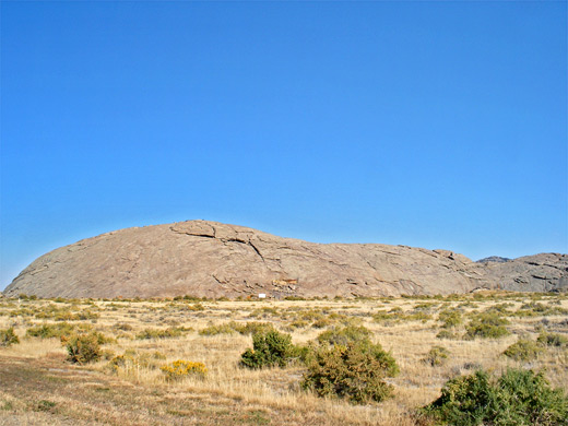
One of the few landmarks in this desolate, uninhabited land is Independence Rock, a rounded granite extrusion rising 128 feet above the level prairie, supposedly named because an ideal schedule would see the travelers reaching this point around Independence Day (July 4th) in order to be able to cross the Sierra Nevada (about 1,000 miles away) before the first snows of winter.
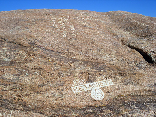
Thousands of the pioneers inscribed or painted their names on the smooth surface of the rock, mostly during the period 1830 to 1900, though the granite bears plenty of more modern additions. Today, a visit here still requires a long drive across a land little changed from the pioneer times, remaining largely roadless and undeveloped.
Independence Rock Table of Contents
Photographs
10 views of Independence Rock.
Independence Rock Location
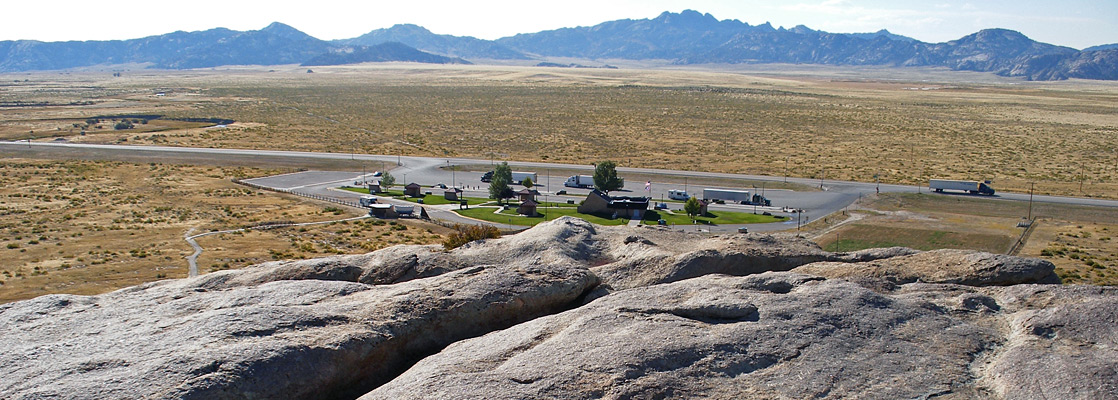
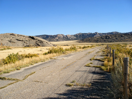
Independence Rock, designated a National Historic Site, now sits rather incongruously next to a rest area along Highway 220, a major cross-state route, busy with truck traffic heading to or from interstate 80. An earlier road, since replaced by the modern route, runs right beside the rock, but this is closed to all vehicles and is gradually becoming overgrown, the cracked surface and encroaching grass adding a touch of poignancy to the scene. The old road crosses the Sweetwater River a short distance south; the river provides a reliable, year-round source of water hence the Oregon Trail ran close by for over 100 miles, across the dry center of Wyoming.
The Rock
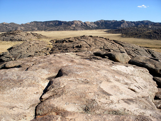
The rock is not well signposted but quite evident when arriving at the Highway 220 rest area; a granite dome 2,000 feet by 500 feet in size surrounded by a sea of tall yellow grass mixed with occasional cacti, reflecting the relatively low elevation and arid climate. An interpretive site with photographs, information boards and an old wagon is located at the edge of the parking lot, from where a short trail leads to the side of the rock, crossing the disused road then forming a one mile loop all around the perimeter. The path passes many inscriptions but most are on top - the granite can be climbed quite easily from several points even though most sides slope too steeply. Once on the summit, the rock is fairly flat, enabling a quick walk from one end to the other. Decades of erosion, weathering and lichen growth has made some of the older inscriptions illegible but there are still many hundreds of names identifiable from the mid 19th century, some with quite lengthy details of dates, intended destinations and a list of all members in the party. Besides its historical interest, Independence Rock is noteworthy for the excellent panorama it provides, as the summit overlooks many square miles of the barren, empty, evocative surroundings. Other peaks in view include the Sentinel Rocks to the south and the Granite Mountains to the west, of which Independence Rock is an outcrop.
Nearby Sites
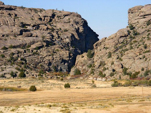
There are several other Oregon Trail-related sites nearby such as a Martin's Cove (a grassy valley where a number of emigrants perished during an early winter snowstorm), a Mormon visitor center/museum, and Devils Gate. This latter is a narrow ravine formed by the Sweetwater River as it cuts through the edge of the Granite Mountains, also inscribed with pioneer names and visible from a BLM site along Highway 220, 6 miles west of Independence Rock. The site has a short loop trail, several noticeboards, and rather distant views - the ravine is about 3/4 mile north, though it can be approached by several lesser roads.
Independence Rock - Nearby Places
- Sinks Canyon State Park (105 miles) - limestone cave along the Popo Agie River
Independence Rock - Similar Places
- Enchanted Rock State Natural Area, Texas - unusual pinkish granite rock in the Hill Country near Fredericksburg
All Contents © Copyright The American Southwest | Comments and Questions | Contribute | Affiliate Marketing Disclosure | Site Map
