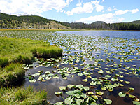
Harlequin Lake Trail, Yellowstone National Park
Wyoming > Yellowstone National Park > The Northwest > Hiking > Harlequin Lake Trail
Harlequin Lake
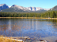
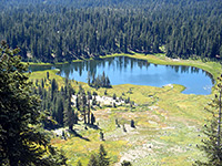
Harlequin is a minor, shallow but quite pretty lake at the foot of Purple Mountain, near Madison Junction, and may be reached by a short trail through new growth pines
Length: 0.4 miles
Elevation change: 100 feet
Difficulty: Easy
Type: One way
Usage: Low to medium
Season: Summer, fall
Trailhead: North side of US 20/191, opposite a large parking area
Rating (1-5): ★★★★★
Elevation change: 100 feet
Difficulty: Easy
Type: One way
Usage: Low to medium
Season: Summer, fall
Trailhead: North side of US 20/191, opposite a large parking area
Rating (1-5): ★★★★★
Although very short (0.4 miles), and beginning along the busy highway from West Yellowstone, the path to Harlequin Lake is peaceful and little used, leading through new growth lodgepole pine forest to a shallow but scenic and secluded lake at the north side of Madison Canyon, far enough from the road to escape all traffic noise.
The marshy surroundings are good habitat for birds, elk, beaver and other wildlife (including mosquitoes), and while there isn't much else of interest in the vicinity, the trail provides an interesting diversion for an hour or so.
Trail map for Yellowstone National Park.
The inconspicuous trailhead for the Harlequin Lake hike is on the north side of the highway, 12 miles east of the national park entrance gate near West Yellowstone and 1.5 miles west of Madison Campground.
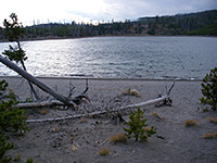
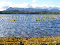
Trailhead parking is on the opposite (south) side of the highway, at a long, elevated pull-out overlooking a large meadow bordering the Madison River, a good location from which to look for wildlife, and also used by people fishing in the river. Despite being so short, the trail still has a register and the usual Yellowstone backcountry hiking information including warnings about possible bear encounters. The path heads north across the edge of a patch of land severely burnt in the 1988 wildfires, through replacement forest of thin pine trees around 10 feet tall. It climbs a little, levels out, turns west and drops down slightly to the edge of the lake, from where a fainter path follows the south shore, across fallen tree trunks and boggy areas. Much of the lake is lined by reeds and covered by lily pads that bear yellow flowers in summer, though the middle has open water. A steep hillside rises up by 1,400 feet to the north, forming the edge of flat-topped Purple Mountain; another trail 2 miles east climbs to the top of the hill, for good views along the Madison River canyon.
The marshy surroundings are good habitat for birds, elk, beaver and other wildlife (including mosquitoes), and while there isn't much else of interest in the vicinity, the trail provides an interesting diversion for an hour or so.
Location
Trail map for Yellowstone National Park.
Harlequin Lake Trailhead
The inconspicuous trailhead for the Harlequin Lake hike is on the north side of the highway, 12 miles east of the national park entrance gate near West Yellowstone and 1.5 miles west of Madison Campground.
The Trail
Trailhead parking is on the opposite (south) side of the highway, at a long, elevated pull-out overlooking a large meadow bordering the Madison River, a good location from which to look for wildlife, and also used by people fishing in the river. Despite being so short, the trail still has a register and the usual Yellowstone backcountry hiking information including warnings about possible bear encounters. The path heads north across the edge of a patch of land severely burnt in the 1988 wildfires, through replacement forest of thin pine trees around 10 feet tall. It climbs a little, levels out, turns west and drops down slightly to the edge of the lake, from where a fainter path follows the south shore, across fallen tree trunks and boggy areas. Much of the lake is lined by reeds and covered by lily pads that bear yellow flowers in summer, though the middle has open water. A steep hillside rises up by 1,400 feet to the north, forming the edge of flat-topped Purple Mountain; another trail 2 miles east climbs to the top of the hill, for good views along the Madison River canyon.
Harlequin Lake Trail - Similar Hikes
All Contents © Copyright The American Southwest | Comments and Questions | Contribute | Affiliate Marketing Disclosure | Site Map


