Yellowstone River Picnic Area Trail, Yellowstone National Park
Wyoming > Yellowstone National Park > The North > Hiking > Yellowstone River Picnic Area Trail
Yellowstone
River Picnic Area
This good but lightly traveled trail follows the east side of the cliffs at the downstream end of the Grand Canyon of the Yellowstone River, passing many good viewpoints of the canyon and the surrounding hills
Length: 2 miles
Elevation change: 400 feet
Difficulty: Easy
Type: One way. Links with the Specimen Ridge Trail. A 3.6 mile loop can be made via an alternative return path
Usage: Low to medium
Season: Summer, fall
Trailhead: Yellowstone River Picnic Area
Rating (1-5): ★★★★★
Elevation change: 400 feet
Difficulty: Easy
Type: One way. Links with the Specimen Ridge Trail. A 3.6 mile loop can be made via an alternative return path
Usage: Low to medium
Season: Summer, fall
Trailhead: Yellowstone River Picnic Area
Rating (1-5): ★★★★★
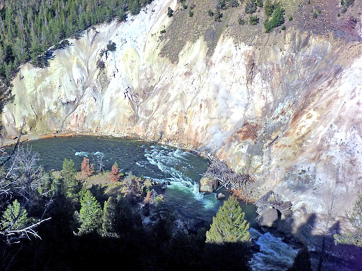
For most of its 20 mile length the Grand Canyon of the Yellowstone River is unreachable by trail, enclosed by steep, wooded terrain; only the upper and lower ends are easily accessed, and while the south part is the most spectacular (best experienced by the Seven Mile Hole Trail), the northern (downstream) section is also scenic, viewed either from overlooks on the west rim, along the highway, or more peacefully by the Yellowstone River Picnic Area Trail, which follows the east rim for 2 miles. The canyon walls soon become 400 feet high, and in a short distance the river flows over rapids, past some hot springs, through a confined section known as the Narrows and on to a confluence with Tower Creek, where the surrounding basalt cliffs have been eroded into unusual pointed formations.
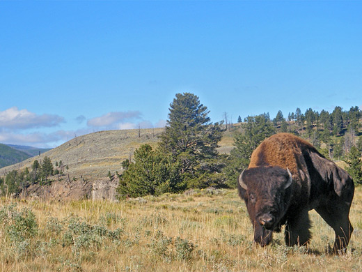
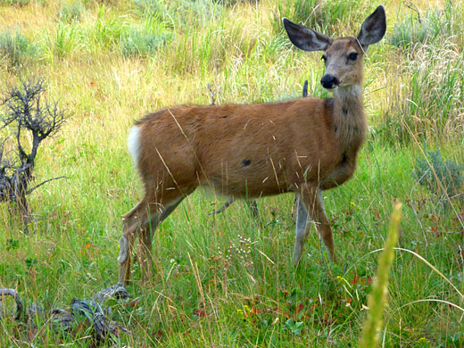
The hike ends at a fine viewpoint over several more miles of the river, as it twists northwards through a wide valley between hills of increasing height. On the other side of the trail, east of the canyon, is a rolling landscape of grassland and forest, good habitat for bison, deer, bighorn sheep and bears. The path is relatively little traveled, and a round trip to the viewpoint takes 2 hours or less.
Trail map for Yellowstone National Park.
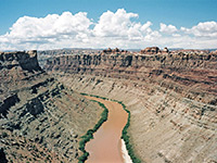
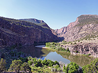
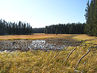
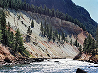
10 views along the Yellowstone River Picnic Area Trail.
As its name suggests, the hike begins at the Yellowstone River Picnic Area, a small enclosure with limited parking, in a sheltered, wooded clearing 1.2 miles east of Tower Junction, close to but out of sight of the river. The place is not obviously signed as a trailhead from the highway but there is a trail notice at one side, from where the path climbs quite steeply up a sagebrush-covered hillside past a huge glacial boulder to the top of a narrow ridge next to the canyon; the rest of the hike is then along the rim, mostly right on the edge and so giving unobscured views down to the river. The canyon is formed by hills rising up rather than the river eroding downwards, and takes shape over a comparatively short distance, as the walls increase in height from just a few feet around the highway bridge to 400 feet in less than a mile. Trees grow in some locations but most of the land on the rim is covered only by short grass. In the other direction the land slopes down much more gently towards the highway and the Lamar Valley, with meadows, patches of fir/pine woodland and occasional small, steep hills.
The trail climbs gradually for 2 miles to a high point opposite Tower Falls, for the best views, looking south over another few miles of the river as it flows from the north between steep-sided mountains. Before this, the path passes high above Calcite Springs, a collection of sulphurous steam vents at river level surrounded by a sizeable area of colorful, mineralized earth, and then the Narrows, where the volcanic canyon walls are nearly vertical, and just 500 feet apart at rim level. Tower Creek joins from the west just beyond here, as the cliffs become rather less steep, allowing a spur path to descend all the way to the river, to the site of an ancient Indian crossing of the river at Bonners Ford. This path branches off a short distance beyond the high point, after the trail turns east and descends a little, to a four-way junction, the other two routes being the long Specimen Ridge Trail, which starts from an alternative trailhead along the highway 0.7 miles east of the picnic area, and ends 17 miles later beside the Lamar River. A 3.6 mile loop can be made by walking west down the first part of this trail, then along a fainter path beside the road back to the start point.
The hike ends at a fine viewpoint over several more miles of the river, as it twists northwards through a wide valley between hills of increasing height. On the other side of the trail, east of the canyon, is a rolling landscape of grassland and forest, good habitat for bison, deer, bighorn sheep and bears. The path is relatively little traveled, and a round trip to the viewpoint takes 2 hours or less.
Location
Trail map for Yellowstone National Park.
Photographs
10 views along the Yellowstone River Picnic Area Trail.
Start of the Trail
As its name suggests, the hike begins at the Yellowstone River Picnic Area, a small enclosure with limited parking, in a sheltered, wooded clearing 1.2 miles east of Tower Junction, close to but out of sight of the river. The place is not obviously signed as a trailhead from the highway but there is a trail notice at one side, from where the path climbs quite steeply up a sagebrush-covered hillside past a huge glacial boulder to the top of a narrow ridge next to the canyon; the rest of the hike is then along the rim, mostly right on the edge and so giving unobscured views down to the river. The canyon is formed by hills rising up rather than the river eroding downwards, and takes shape over a comparatively short distance, as the walls increase in height from just a few feet around the highway bridge to 400 feet in less than a mile. Trees grow in some locations but most of the land on the rim is covered only by short grass. In the other direction the land slopes down much more gently towards the highway and the Lamar Valley, with meadows, patches of fir/pine woodland and occasional small, steep hills.
Scenery
The trail climbs gradually for 2 miles to a high point opposite Tower Falls, for the best views, looking south over another few miles of the river as it flows from the north between steep-sided mountains. Before this, the path passes high above Calcite Springs, a collection of sulphurous steam vents at river level surrounded by a sizeable area of colorful, mineralized earth, and then the Narrows, where the volcanic canyon walls are nearly vertical, and just 500 feet apart at rim level. Tower Creek joins from the west just beyond here, as the cliffs become rather less steep, allowing a spur path to descend all the way to the river, to the site of an ancient Indian crossing of the river at Bonners Ford. This path branches off a short distance beyond the high point, after the trail turns east and descends a little, to a four-way junction, the other two routes being the long Specimen Ridge Trail, which starts from an alternative trailhead along the highway 0.7 miles east of the picnic area, and ends 17 miles later beside the Lamar River. A 3.6 mile loop can be made by walking west down the first part of this trail, then along a fainter path beside the road back to the start point.
Yellowstone River Picnic Area Trail - Similar Hikes
All Contents © Copyright The American Southwest | Comments and Questions | Contribute | Affiliate Marketing Disclosure | Site Map


