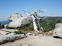
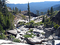
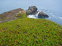
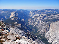
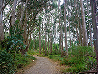
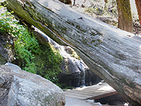
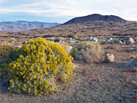
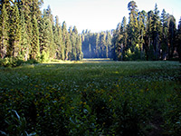
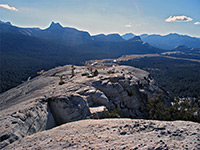
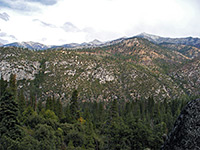
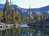
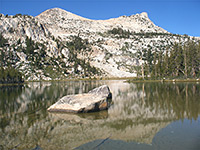
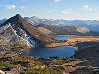
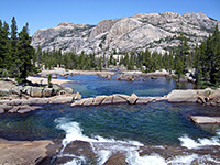
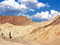
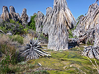
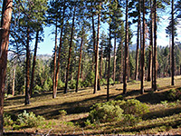
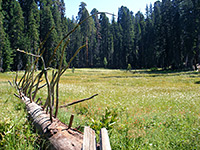
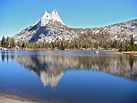
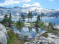
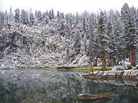
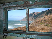
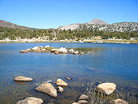
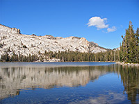
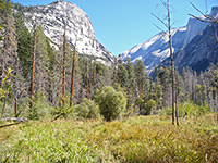
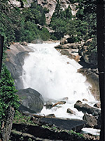
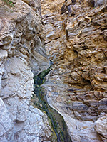
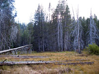
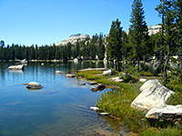
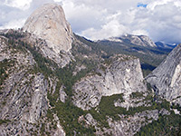
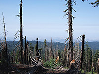
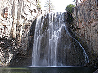
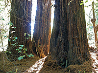
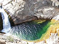
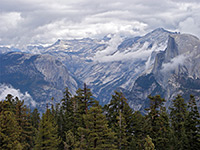
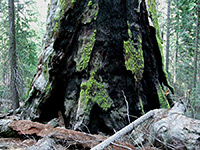
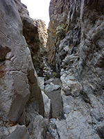
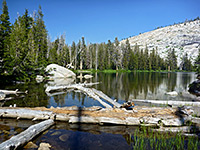
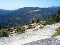
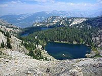
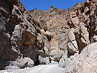
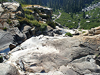
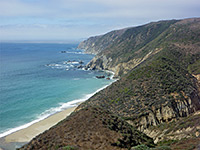
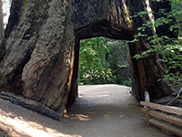
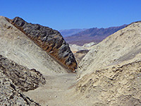
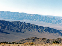
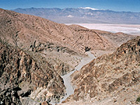
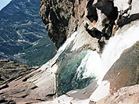
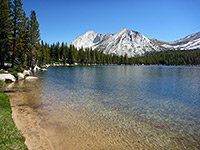
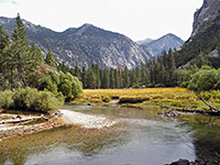
The central third of California contains most of the state's famous national parks: Death Valley, Kings Canyon, Sequoia and Yosemite, together with other spectacular hiking areas like Devils Postpile, Lake Tahoe, Muir Woods and Mono Lake.
Map shows trailhead locations
| 1. Alamere Falls and Wildcat Beach, Point Reyes National Seashore Length 5.5 miles (8.8 km); to Wildcat Beach Elevation change 100 feet (30 meters) Difficulty Easy to moderate, depending on the distance Rating (1-5) ★★★★★ Varied destinations along the southern section of the Coast Trail: several freshwater lakes, an unusual shoreline waterfall and a long sandy beach. The path alternates between grassy bluffs and thick woodland, generally staying some way above the ocean. |
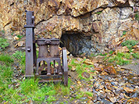
| 2. Bennettsville Mine Trail, Yosemite National Park Length 1.4 miles (2.3 km) Elevation change 100 feet (30 meters) Difficulty Easy Rating (1-5) ★★★★★ Short but seldom hiked trail that crosses lightly wooded, high elevation terrain, past a few ponds, to the site of the old gold mining settlement of Bennettsville, where relics include spoil heaps, a sealed tunnel and several pieces of iron equipment. |
| 3. Big Baldy, Kings Canyon National Park Length 2.2 miles (3.5 km) Elevation change 650 feet (198 meters) Difficulty Easy Rating (1-5) ★★★★★ 8 miles from Grant Grove at the east edge of the national park, the route to the granite summit of 8,209 foot Big Baldy is along a well marked trail through pine forest interspersed by open areas. Views from the top encompass densely-forested Redwood Canyon to the west, Little Baldy to the south, and many higher peaks to the east, around the Jennie Lakes Wilderness Area and beyond. |
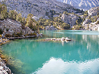
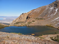
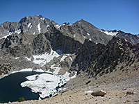
| 4. Big Pine Lakes, Big Pine Lakes Length 11 miles (17.7 km); for the basic loop Elevation change 3400 feet (1036 meters) Difficulty Strenuous Rating (1-5) ★★★★★ Nine beautiful glacial lakes high up the eastern slopes of the Sierra Nevada, nestled beneath 14,000 foot peaks. Reached by a trail that climbs along the North Fork of Pine Creek, past a waterfall, then starts a loop round six of the lakes. Spur paths lead to the other lakes, and to the base of Palisade Glacier. |
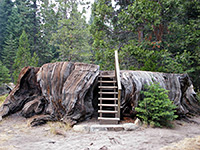
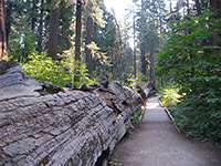
| 5. Big Stump, Kings Canyon National Park Length 2 miles (3.2 km); (loop) Elevation change 200 feet (61 meters) Difficulty Easy Rating (1-5) ★★★★★ Starting from the Big Stump entrance station on CA 180, this easy trail loops through a basin that was extensively logged in the 1880s but is now recovering after being added to the park in 1958 and so protected from any more commercial activity. Several short spur paths lead to particular stumps and fallen trees bearing evocative names such as Sawed Tree, Burnt Monarch and Shattered Giant. |
| 6. Big Trees Trail, Sequoia National Park Length 1.2 miles (1.9 km); (loop) Elevation change 60 feet (18 meters) Difficulty Easy Rating (1-5) ★★★★★ The Big Trees Trail starts next to Giant Forest Museum and winds around the edge of a large grassy clearing (Round Meadow), filled with countless wildflowers in spring and summer, and lined by several very large sequoia. The path is paved, wheelchair accessible and has trailside exhibits. |
| 7. Bishop Pass Trail, Eastern Sierra Length 7.5 miles (12.1 km); to the basin Elevation change 2150 feet (655 meters) Difficulty Moderate, becoming more strenuous around the pass Rating (1-5) ★★★★★ Spectacular trail past six lakes and many Alpine meadows to an 11,972 foot mountain pass near Mt Agassiz, continuing into Dusy Basin in Kings Canyon National Park. Particularly good for wildflowers in the summer |
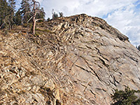
| 8. Black Point Fissures, Mono Lake Length 1 mile (1.6 km) Elevation change 500 feet (152 meters) Difficulty Easy Rating (1-5) ★★★★★ Black Point is a flat-topped hill on the north side of Mono Lake, split by several deep, narrow, slot canyon-like fissures, through layered volcanic rocks with unusual textures and colors. Reached by a relatively easy off-trail walk. |
| 9. Buena Vista Peak, Kings Canyon National Park Length 0.8 miles (1.3 km) Elevation change 420 feet (128 meters) Difficulty Easy Rating (1-5) ★★★★★ This faint trail leads from a small parking area a little way south of Kings Canyon Overlook, on the Generals Highway southeast of the main Grant Grove area, to a treeless, granite summit that has a 360 degree view over the surrounding forest, mountains and canyons. |
| 10. Camp Nelson Trail, Giant Sequoia National Monument Length 3.6 miles (5.8 km) Elevation change 1650 feet (503 meters) Difficulty Moderate; steep at the upper end Rating (1-5) ★★★★★ Tranquil path alongside the Middle Fork of the Tule River through two unspoilt sequoia groves (Wheel Meadow and McIntyre), passing a good selection of living and fallen trees. Also popular with cyclists. |
| 11. Chilnualna Falls, Yosemite National Park Length 4.1 miles (6.6 km) Elevation change 2000 feet (610 meters) Difficulty Moderate to strenuous Rating (1-5) ★★★★★ Lightly used path to the highest Yosemite waterfall outside the main valley; it climbs steadily through mostly wooded land with limited views at first, then reaches the sparkling granite landscape around the falls. Upstream are pools, deep channels and other cascades. |
| 12. Chimney Rock Trail, Point Reyes National Seashore Length 0.9 miles (1.4 km) Elevation change 50 feet (15 meters) Difficulty Easy Rating (1-5) ★★★★★ Chimney Rock is a detached pinnacle on the opposite side of Point Reyes from the lighthouse, viewed at the end of a short path along an exposed, cliff-bound peninsula, which gives excellent views of the south-facing coastline of the national seashore. The peninsula is a renowned location for spring wildflowers, and also the site of a historic lifeboat station. |
| 13. Clouds Rest, Yosemite National Park Length 2 miles (3.2 km); from the north Elevation change 850 feet (259 meters) Difficulty Moderate Rating (1-5) ★★★★★ Clouds Rest is a rounded granite summit, 1,090 feet higher than the more well known Half Dome but offering similar, if not better, views of Yosemite Valley and countless square miles of the backcountry. The peak can be approached either from the south, starting in the valley, or from the north beginning along the Tioga Road - the southern end of the 5 mile Clouds Rest Trail, which leads to the summit, branches off the John Muir Trail, while the northern terminus is at a junction with the Forsyth Trail. |
| 14. Coast Trail, Point Reyes National Seashore Length 16.5 miles (26.5 km); level overall Elevation change feet ( meters) Difficulty Easy to moderate, depending on the distance Rating (1-5) ★★★★★ The majority of the Coast Trail is along grassy bluffs within sight of though somewhat above the ocean, with regular access points down to the beaches. The northern terminus is just off Limantour Road, while the southern end is at the Palomarin Trailhead along Mesa Road from Bolinas. This latter is the most used start point because of the variety of interesting locations reachable after a few hours, including a selection of lakes and the unusual Alamere Falls (along a 0.4 mile spur), one of only two significant ocean-side waterfalls in California |
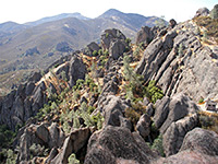
| 15. Condor Gulch, Pinnacles National Park Length 1.7 miles (2.7 km) Elevation change 1100 feet (335 meters) Difficulty Moderate Rating (1-5) ★★★★★ One of four paths that lead towards the main volcanic pinnacles, the Condor Gulch Trail climbs a side ravine covered by chaparral vegetation typical of the lower elevations of the park, passes an overlook (after 1 mile) with fine views west to the rocky summit and south back towards Bear Gulch, before ending at an intersection with the High Peaks Trail. |
| 16. Congress Trail, Sequoia National Park Length 2 miles (3.2 km); loop Elevation change 160 feet (49 meters) Difficulty Easy Rating (1-5) ★★★★★ Starting at the famous General Sherman tree (a third of a mile downhill from the nearest parking area), this easy, paved path loops past numerous other large sequoias, some bearing governmental names including the Senate and House groups, the President tree (240 feet tall), General Lee tree and McKinley tree. The path offers one of the best introductions to the scenery of the forest, but is apt to be quite busy, and some parts are close enough to the highway to experience some traffic noise. |
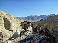
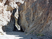
| 17. Corkscrew Canyon, Death Valley National Park Length 4.3 miles (6.9 km); round trip, to the mine and the narrows Elevation change 800 feet (244 meters) Difficulty Easy Rating (1-5) ★★★★★ Shallow, branched drainage through undulating, yellowish badlands. One fork forms a pretty section of narrows, while another contains an old mine site including a well preserved wooden structure used for ore processing. |
| 18. Cottonwood Lakes Trail, Eastern Sierra Length 5.7 miles (9.2 km) Elevation change 1500 feet (457 meters) Difficulty Moderate to strenuous; not too steep, but fairly long Rating (1-5) ★★★★★ Path alongside a wooded creek, climbing fairly gently above the timberline, past meadows and boggy areas, to a high basin containing several beautiful lakes, directly beneath the Sierra crest |
| 19. Crater Mountain, Eastern Sierra Length 1.8 miles (2.9 km) Elevation change 1130 feet (344 meters) Difficulty Easy to moderate Rating (1-5) ★★★★★ Off-trail walk over open terrain, through black and red lava formations, to a flattish volcanic summit overlooking Owens Valley |
| 20. Crescent Meadow and Log Meadow, Sequoia National Park Length 2.0 miles (3.2 km); (loop) Elevation change 190 feet (58 meters) Difficulty Easy Rating (1-5) ★★★★★ Tranquil paths around two lush meadows, surrounded by flourishing sequoia and a selection of huge fallen trees. Also passes Tharps Log, a historic cabin built in a hollow trunk. |
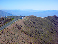
| 21. Dantes Peak, Death Valley National Park Length 0.4 miles (0.6 km) Elevation change 300 feet (91 meters) Difficulty Easy Rating (1-5) ★★★★★ Starting from Dante's View, the spectacular mountain overlook on the west side of Death Valley, 5,700 feet above Badwater. A short path leads to a summit (Dante's Peak) a little way north. |
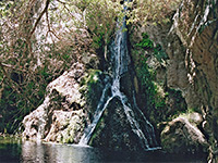
| 22. Darwin Canyon, Death Valley National Park Length 1.5 miles (2.4 km); to the canyon above the waterfalls Elevation change 500 feet (152 meters) Difficulty Easy to the base of the falls; moderate beyond Rating (1-5) ★★★★★ Darwin Canyon contains one of the highest waterfalls in the national park (80 feet), plus smaller falls and cascades, deep pools and a permanent stream running through a narrow, boulder-filled gorge, all fed by springs high up the ravine. The falls are easily reached by a maintained trail to the base then by lesser paths that continue upstream. |
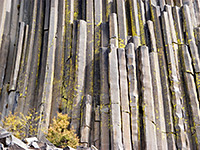
| 23. Devils Postpile Trail, Devils Postpile National Monument Length 0.4 miles (0.6 km) Elevation change 100 feet (30 meters) Difficulty Easy Rating (1-5) ★★★★★ Path to the central feature of the national monument, a rare volcanic outcrop of hexagonal basalt columns - beside the San Joaquin River in the eastern Sierra Nevada. |
| 24. Dog Lake and Lembert Dome, Yosemite National Park Length 2 miles (3.2 km) Elevation change 850 feet (259 meters) Difficulty Easy to moderate Rating (1-5) ★★★★★ Popular trail that ascends through thick pine forest beneath a large granite dome, then levels out and continues north, still through the woods, to the edge of Dog Lake, which is also enclosed by trees. Best views are from the top of the dome, reached by a short off-trail hike. |
| 25. Don Cecil Trail, Kings Canyon National Park Length 6 miles (9.7 km); to the summit meadow Elevation change 3300 feet (1006 meters) Difficulty Strenuous Rating (1-5) ★★★★★ Named after a 19th century shepherd, the Don Cecil Trail was once the main access route into Kings Canyon, linking Cedar Grove with a forest track that starts from CA 198 and follows Big Meadow Creek eastwards. From the grove, the trail climbs steeply and continuously to a meadow beneath 8,500 foot Lookout Peak from where a short spur path leads to the summit, a point that provides excellent panoramas over the canyon and the surrounding peaks. One target for a shorter hike is Sheep Creek Cascade after 1 mile (a 600 foot elevation gain). |
| 26. Eagle Falls Trail, Lake Tahoe Length 4.5 miles (7.2 km); to Upper Velma Lake Elevation change 1600 feet (488 meters) Difficulty Strenuous Rating (1-5) ★★★★★ Quickest route into the beautiful granite backcountry of the Desolation Wilderness, first passing a waterfall and a secluded lake, then climbing steeply to an elevated plateau, and on to Upper Velma Lake. Other lakes are close by, further into the mountains. |
| 27. Elizabeth Lake, Yosemite National Park Length 2.4 miles (3.9 km) Elevation change 850 feet (259 meters) Difficulty Easy Rating (1-5) ★★★★★ One of few trails that does not link with any others, this begins at the Tuolumne Meadows Campground and follows the east side of Unicorn Creek through woodland to Elizabeth Lake, situated beneath high peaks of the Cathedral Range. The glacial lake is ringed by grassy meadows and is a good destination for a half day hike. |
| 28. Fossil Falls, Fossil Falls Length 0.2 miles (0.3 km) Elevation change 0 feet (0 meters) Difficulty Easy Rating (1-5) ★★★★★ Dryfalls in a narrow ravine through thick lava deposits, along an ancient course of the Owens River in Owens Valley; swirling, eroded rock formations, plus views of nearby cinder cones and the Sierra Nevada; accessed by a very short path over the lava. |
| 29. Gaylor Lakes, Yosemite National Park Length 2 miles (3.2 km); to Great Sierra Mine Elevation change 860 feet (262 meters) Difficulty Moderate - steep ascent near the start Rating (1-5) ★★★★★ Starting right next to the eastern park entrance, the easy trail to Middle & Upper Gaylor Lakes climbs a hillside, passing through pine trees at first then grassland, crosses a ridge to the first lake and continues a short distance north to the second. Just to the west (off trail) are the two Granite Lakes while half a mile further on the path are the remains of Great Sierra Mine, an unsuccessful silver operation started in the 1880s. Various shafts and stone cabins can still be seen. |
| 30. General Grant Tree, Kings Canyon National Park Length 0.3 miles (0.5 km); (loop) Elevation change 30 feet (9 meters) Difficulty Easy Rating (1-5) ★★★★★ The paved, wheelchair accessible, self-guiding path to General Grant, the 3rd largest tree on Earth, begins 1 mile northwest of the Grant Grove visitor center, and also passes numerous other large trees with official names. This is the one must-do trail in Grant Grove if time is limited. The path is reached by a short, paved side road, that descends a little to a large parking area. |
| 31. Glen Aulin, Yosemite National Park Length 5.3 miles (8.5 km); to the campground Elevation change 600 feet (183 meters) Difficulty Moderate Rating (1-5) ★★★★★ Path alongside the Tuolumne River, at first over level terrain of meadows and patches of woodland, with good views of the surrounding mountains. After a few miles it descends into a granite gorge, passing many deep pools, several spectacular waterfalls, and beautiful granite landscapes. |
| 32. Golden Canyon/Gower Gulch, Death Valley National Park Length 4.3 miles (6.9 km); including the short side trip to the Red Cathedral Elevation change 700 feet (213 meters) Difficulty Moderate; heat might be the main difficulty, rather than the terrain Rating (1-5) ★★★★★ Twisting ravines through fantastically colored badlands below Zabriskie Point on the east side of Death Valley, toured by a loop trail; one of the most popular paths in the national park. |
| 33. Grapevine Springs, Death Valley National Park Length 5 miles (8 km); round trip Elevation change 650 feet (198 meters) Difficulty Easy to moderate; requires cross-country navigation Rating (1-5) ★★★★★ California fan palm oases, shallow canyons and hot springs in a rarely-visited area near Scottys Castle. Most of the palm trees are dead, but still photogenic, lying at the center of largest natural, riparian environment in the national park. |
| 34. Grey Wall Canyon Length 5 miles (8 km); to the fork in the canyon Elevation change 1000 feet (305 meters) Difficulty Easy to moderate; no major obstacles, but quite a long hike Rating (1-5) ★★★★★ Long, twisting ravine through the northern Grapevine Mountains; shallow narrow passageways bordered by banded igneous rocks. |
| 35. Grotto Canyon Length 3 miles (4.8 km); or longer Elevation change 1200 feet (366 meters) Difficulty Moderate to strenuous - frequent high dryfalls which may either be free-climbed, or bypassed by retreating a way and scaling the steep slopes at either side Rating (1-5) ★★★★★ Perhaps the most beautiful narrows in Death Valley - a long succession of enchanting passages through light-colored rocks, often polished smooth by floodwaters. Many enclosed chambers, dryfalls and chokestones. |
| 36. Hazelwood Nature Trail, Sequoia National Park Length 1.0 miles (1.6 km); (loop) Elevation change 50 feet (15 meters) Difficulty Easy Rating (1-5) ★★★★★ Hazelwood is an easy path through tall trees alongside a small stream (Little Deer Creek) and is accompanied by various trailside information notices about the sequoia, and man's impact on them. The trailhead is located next to Giant Forest Lodge. |
| 37. High Peaks Trail, Pinnacles National Park Length 5.1 miles (8.2 km) Elevation change 1500 feet (457 meters) Difficulty Moderate Rating (1-5) ★★★★★ The main route into the high mountains of Pinnacles National Park, passing through the center of the largest volcanic formations around Hawkins Peak, is a moderately difficult hike that has excellent views for most of its 5 mile length. The full path starts and ends at points 1.6 miles apart, though the intersecting Condor Gulch Trail allows for a slightly shorter loop hike of 6 miles. |
| 38. Hotel Creek/ Cedar Grove Overlook, Kings Canyon National Park Length 3 miles (4.8 km); to Cedar Grove Overlook Elevation change 1500 feet (457 meters) Difficulty Moderate Rating (1-5) ★★★★★ From the Cedar Grove campground, this trail climbs steeply at first close to the valley of Hotel Creek, then more gently across the hillsides to the west. A spur path leads to the end of a ridge overlooking the grove, while the main route continues north and intersects the Lewis Creek Trail. As the trail climbs the south-facing side of Kings Canyon, it is liable to be in full sun all day. |
| 39. Huckleberry Trail, Sequoia National Park Length 4.0 miles (6.4 km); (loop) Elevation change 400 feet (122 meters) Difficulty Easy to moderate Rating (1-5) ★★★★★ The first part of this route is along the Hazelwood Nature Trail, from which two continuation paths branch off and form a 4 mile loop, leading through meadows and sequoia woodland, to an old log cabin built around 1880 (Squatters Cabin - reached after 1.5 miles), and the Washington Tree which used to be the second largest in Sequoia National Park but partially collapsed in January 2005 following a fire. Junctions along the way lead to various other destinations including Crescent Meadow, Tharps Log and the Congress Group. |
| 40. John Muir (west), Yosemite National Park Length 3.5 miles (5.6 km); to the Cathedral Lakes Elevation change 1340 feet (408 meters) Difficulty Moderate Rating (1-5) ★★★★★ The westward part of the John Muir Trail climbs the wooded hillside above Budd Creek for half a mile then turns away to the west, skirting the high cliffs beneath Cathedral Peak. The trees thin out as the path reaches a junction with a short spur that drops to Lower Cathedral Lake, one of the most popular destinations on this part of the park on account of its spectacular setting, beneath smooth granite slopes and peaks. The main trail soon approaches the upper lake, reaches a high point at Cathedral Pass then begins a long descent towards Yosemite Valley. |
| 41. Lake Aloha, Lake Tahoe Length 5.1 miles (8.2 km) Elevation change 1600 feet (488 meters) Difficulty Strenuous Rating (1-5) ★★★★★ Popular path leading to several beautiful lakes in the Desolation Wilderness, most spectacular being Lake Aloha - a large, shallow, high elevation lake dotted with tiny islands and surrounded on all sides by stark white granite, with very few trees. En route the path passes Susie Lake and Heather Lake. |
| 42. Lakes Trail, Sequoia National Park Length 5.8 miles (9.3 km); to Pear Lake Elevation change 2270 feet (692 meters) Difficulty Moderate to strenuous Rating (1-5) ★★★★★ From Wolverton Creek, at the end of the spur rood south of Lodgepole Visitor Center, this trail climbs steadily up the mountain slopes and passes close to four beautiful glacial lakes - Heather, Aster, Emerald and Pear. The trail ends just north of 11,204 foot Alta Peak, though still nearly 2,000 feet below; the summit can however be reached via the Alta Trail, which runs close to the Lakes Trail and may be joined via the short Panther Gap cut-off trail after 1.7 miles. |
| 43. Little Lakes Valley Trail, Eastern Sierra Length 3.7 miles (6 km) Elevation change 890 feet (271 meters) Difficulty Moderate; only gentle gradients Rating (1-5) ★★★★★ Relatively easy and popular path that climbs a scenic valley containing over a dozen small lakes, up to Morgan Pass, along a subsidiary ridge east of the Sierra crest. The scenery is sparsely wooded, with meadows, several streams and much exposed granite |
| 44. Lost Coast National Recreation Trail, Lost Coast Length 5 miles (8 km) Elevation change 100 feet (30 meters) Difficulty Easy to moderate Rating (1-5) ★★★★★ Long distance (25 mile) path between Mattole Beach and Shelter Cove. The northernmost 5 miles pass a good variety of sites including an old lighthouse, abandoned cabins, extensive tidepools and several ravines into the adjacent mountains. |
| 45. Lost Trail, Muir Woods National Monument Length 0.5 miles (0.8 km) Elevation change 400 feet (122 meters) Difficulty Easy Rating (1-5) ★★★★★ This path starts along the Panoramic Highway a short distance north of the national monument, descends a little to a junction with the upper end of the Ocean View Trail then drops very steeply through pleasant, airy forest via many wooden steps, down to the upper end of the main valley, where it meets the Fern Creek Trail. All is just outside the monument boundary. |
| 46. Lower Gaylor Lake, Yosemite National Park Length 2.5 miles (4 km) Elevation change 800 feet (244 meters) Difficulty Easy Rating (1-5) ★★★★★ Another trail to the Gaylor Lakes starts 4 miles beyond the main route, just west of Dana Meadows - this less-used path leads into the hills alongside the lake outlet stream, ending by the southern shore of Lower Gaylor Lake after 2.5 miles. The others can then be by reached a short walk cross-country. All this area is surrounded by high granite peaks and is very scenic. |
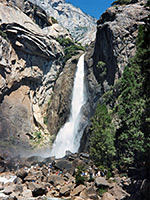
| 47. Lower Yosemite Fall, Yosemite National Park Length 0.5 miles (0.8 km) Elevation change 50 feet (15 meters) Difficulty Easy Rating (1-5) ★★★★★ Probably the most used path in the park is the easy walk to the base of Lower Yosemite Fall, starting by the Northside Drive near Yosemite Lodge (shuttle stop number 6). Although the falls often dry up completely by late summer, the cascade is usually an impressive site all year round, causing the area around the base to be covered by spray. |
| 48. Lukens Lake, Yosemite National Park Length 1 mile (1.6 km); to the lake Elevation change 160 feet (49 meters) Difficulty Easy Rating (1-5) ★★★★★ This easy but not too interesting path leads northwards from a trailhead along the Tioga Road, across a saddle then on to Lukens Lake and its adjoining meadow (good for wildflowers in summer). After the lake, the route continues another 5 miles to an intersection with the Pate Valley Trail. Most of the land in this part of the park is wooded and gently hilly, without any high granite peaks or deep valleys. |
| 49. May Lake, Yosemite National Park Length 1.2 miles (1.9 km) Elevation change 300 feet (91 meters) Difficulty Easy Rating (1-5) ★★★★★ The short path to May Lake and the High Sierra Camp located nearby begins from the end of a 1.7 mile side road a few miles east of Porcupine Flat, and ascends through woods and over granite slopes to the east shore. Past the lake, the path (now the Ten Lakes Trail) goes on towards Tuolumne Peak and Polly Dome Lakes. |
| 50. Meadow Trail, Point Reyes National Seashore Length 1.5 miles (2.4 km) Elevation change 950 feet (290 meters) Difficulty Moderate Rating (1-5) ★★★★★ The Meadow Trail is one of several routes linking Bear Valley with the Sky Trail along Inverness Ridge, passing mostly through woodland but crossing a large meadow about half way along. It is often hiked along with the nearby Mount Wittenberg Trail to make a 5 mile loop. |
| 51. Mirror Lake, Yosemite National Park Length 0.8 miles (1.3 km) Elevation change 100 feet (30 meters) Difficulty Easy Rating (1-5) ★★★★★ In the lower end of Tenaya Canyon, Mirror Lake is a shallow pond gradually becoming a marshy meadow, and a good place both for spotting wildlife and photographing reflections of the cliffs at either side, including Half Dome, though as with some other water features, it is dry during summer. A paved route (an old service road) leads to the lake, starting from shuttlebus stop number 17 at the east end of the valley drive. |
| 52. Mirror Meadow, Yosemite National Park Length 3 miles (4.8 km); (loop) Elevation change 140 feet (43 meters) Difficulty Easy Rating (1-5) ★★★★★ The path to Mirror Meadow is an extension of that to Mirror Lake. It starts near the end of the old road to the lake, crosses to the south side of Tenaya Creek then follows the stream through woods and patches of meadowland, passing right beneath Half Dome. After 1.5 miles, not far below the point where Tenaya Canyon starts to gain height quite steeply, the path crosses the creek a second time and returns to the trailhead along the north side, passing a junction with the Snow Creek Trail. |
| 53. Mist Falls, Kings Canyon National Park Length 4 miles (6.4 km) Elevation change 800 feet (244 meters) Difficulty Moderate Rating (1-5) ★★★★★ One of Kings Canyon's more spectacular cascades, Mist Falls are reached by a relatively easy trail that starts from the end of the park road and follows the flat valley floor eastwards, through meadows and woodland to a junction. Turning left (north), the path ascends over rockier terrain, passing several lesser cascades before the main falls. |
| 54. Mist Trail, Yosemite National Park Length 3 miles (4.8 km); to Nevada Fall Elevation change 1840 feet (561 meters) Difficulty Moderate Rating (1-5) ★★★★★ The Mist Trail is the main way to see beautiful Vernal and Nevada falls, two of the most popular attractions of Yosemite Valley. The first part of the route is along the John Muir Trail, following the north side of the Merced River, starting from the Happy Isles Bridge at the far end of the paved road. The Mist Trail forks off left soon after a footbridge over the river, from where Vernal Fall can first be glimpsed, at the head of a short ravine. The path approaches quite close to the base then climbs very steeply to the top via over 600 steps cut into the granite cliffs. The next half mile is a much gentler ascent through woodland before another rise to the top of Nevada Fall, and a second junction with the John Muir Trail. |
| 55. Monarch Canyon, Death Valley National Park Length 3.5 miles (5.6 km); from Beatty Cutoff Road to the spring Elevation change 1000 feet (305 meters) Difficulty Strenuous, if following the bypass route Rating (1-5) ★★★★★ Rocky ravine through the Funeral Mountains, containing a spring, a stream and a multi-stage, 110 foot waterfall, which can be bypassed by a steep climb. The canyon may be explored from the upper or lower ends. |
| 56. Mono Meadow, Yosemite National Park Length 5 miles (8 km) Elevation change 800 feet (244 meters) Difficulty Easy to moderate Rating (1-5) ★★★★★ Passing over varied terrain of thick forest, open slopes, rivers and meadows, with frequent views over distant granite mountains, the Mono Meadow Trail is a pleasant if little used route. The path starts along the Glacier Point Road and descends 300 feet to Mono Meadow, a long, thin, sometimes marshy clearing along a tributary of Illilouette Creek. Next is a traverse of a less densely wooded hillside, a descent to the main creek, and a crossing of the Buena Vista Trail. |
| 57. Mono Pass, Yosemite National Park Length 4 miles (6.4 km) Elevation change 1000 feet (305 meters) Difficulty Moderate Rating (1-5) ★★★★★ Woodland, marshy meadows and several streams are encountered on this tranquil trail that climbs steadily, above the treeline and on to a pass on the eastern Sierra crest, near which are several small lakes and some old mine workings. Spectacular views of the Great Basin Desert. |
| 58. Montgomery Grove Trail, Montgomery Woods State Natural Reserve Length 3 miles (4.8 km); loop Elevation change 200 feet (61 meters) Difficulty Easy Rating (1-5) ★★★★★ Loop path around a remote, little-visited grove of coastal redwoods along the sheltered valley of Montgomery Creek, a tributary of the South Fork Big River. The grove contains numerous huge, healthy trees and abundant ferns, sustained by a small stream. |
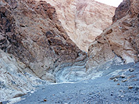
| 59. Mosaic Canyon, Death Valley National Park Length 1.8 miles (2.9 km); to the higher dryfall Elevation change 1000 feet (305 meters) Difficulty Moderate Rating (1-5) ★★★★★ One of many ravines on the north side of Tucki Mountain, containing several sections of shallow but pretty narrows through marble-type rock, plus dryfalls and chokestones. |
| 60. Moses Spring, Pinnacles National Park Length 1.2 miles (1.9 km) Elevation change 300 feet (91 meters) Difficulty Easy Rating (1-5) ★★★★★ The best short hike in the national park is the pleasant trail up Bear Gulch, starting at the visitor center. The route encounters a clear stream, impressive rock formations, many good climbing locations, and a talus cave; it ends beside the dam forming Bear Gulch Reservoir, a good place for a picnic. Running alongside part of the main path, the Bear Gulch Cave Trail descends right through the cave, with some sections that are completely dark and require a torch. |
| 61. Mount Dana, Yosemite National Park Length 3 miles (4.8 km) Elevation change 3100 feet (945 meters) Difficulty Strenuous Rating (1-5) ★★★★★ The steep trail to the summit of Mount Dana, Yosemite's second highest peak, is unofficial but well used and easy to follow, at least as far as the start of the scree and boulders that cover the upper 1,000 feet. From the top stretches a stupendous view right across the Sierras, from California's Central Valley to distant mountain ranges in Nevada. The hike begins right next to the national park entrance station along the Tioga Road. |
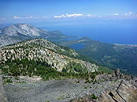
| 62. Mount Tallac Trail, Lake Tahoe Length 5 miles (8 km) Elevation change 3315 feet (1010 meters) Difficulty Strenuous, to the summit Rating (1-5) ★★★★★ Route to the highest peak within 3 miles of Lake Tahoe - past two smaller lakes, in forested surroundings, then over open scree slopes to a sloping ridgeline, and along this to the summit. Fantastic views for most of the way, over the main lake to the east and the Desolation Wilderness to the west. |
| 63. Mount Wittenberg Trail, Point Reyes National Seashore Length 1.9 miles (3.1 km) Elevation change 1320 feet (402 meters) Difficulty Moderate to strenuous Rating (1-5) ★★★★★ 1,407 foot Mount Wittenberg is the highest summit in the park, though long-distance views are very limited as all the peak is densely wooded. Instead, the attractions of the trail to the summit are the cool, often misty surroundings and the variety of plant life en route. Two loop hikes, both a little over 5 miles can be made, returning via the Meadow Trail to the south or the Sky and Horse Trails to the north, while the peak can also be reached, with less elevation gain, from the Sky trailhead along Limantour Road. |
| 64. Murphy Creek, Yosemite National Park Length 6.8 miles (10.9 km); to Glen Aulin Elevation change 440 feet (134 meters) Difficulty Easy to moderate Rating (1-5) ★★★★★ The trailhead for the lightly used path along Murphy Creek is on the Tioga Road next to Tenaya Lake. The route is up a forested valley, over open granite slopes, through more woodland along the creek and into a flat area with various small ponds and lakes beneath 9,806 foot Polly Dome, from where a short hiker-made trail crosses to the shore of the main lake. The trail continues to the Glen Aulin Campsite. |
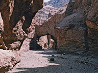
| 65. Natural Bridge Canyon, Death Valley National Park Length 0.8 miles (1.3 km); to the 20 foot dryfall Elevation change 500 feet (152 meters) Difficulty Easy to moderate Rating (1-5) ★★★★★ Ravine through crumbling, greyish conglomerate rocks, containing dryfalls, short narrow sections and a good sized natural bridge. |
| 66. North Grove Trail, Calaveras Big Trees State Park Length 1.8 miles (2.9 km); (loop) Elevation change 50 feet (15 meters) Difficulty Easy Rating (1-5) ★★★★★ Although rather short, the North Grove loop is still long enough to provide a proper walk, taking the visitor well away from the developed area around the park entrance, deep into the quiet, peaceful forest. A trail guide is available describing 25 numbered points of interest including a selection of particularly large trees. |
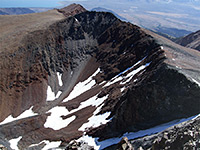
| 67. Onion Valley, Kearsarge Pass, Mt Gould and Golden Trout Lake, Onion Valley, Kearsarge Pass, Mt Gould and Golden Trout Lake Length 8.5 miles (13.7 km); for the full loop Elevation change 3800 feet (1158 meters) Difficulty Strenuous Rating (1-5) ★★★★★ Spectacular loop hike starting at Onion Valley high up in the eastern Sierra Nevada; climbing steadily past four pretty lakes to 11,760 foot Kearsarge Pass, ascending another 1,240 feet to the summit of Mt Gould then returning via an adjacent canyon containing another large lake. |
| 68. Outer Loop (Mariposa Grove), Yosemite National Park Length 7 miles (11.3 km); (loop) Elevation change 1000 feet (305 meters) Difficulty Moderate Rating (1-5) ★★★★★ Starting and finishing at the parking area at the end of the publicly-drivable section of the Mariposa Grove Road, the Outer Loop Trail winds across quite steep, forested slopes passing some sequoias though mostly ponderosa pines. Various shorter paths branch off to points on the road, where most of the large named trees are found. |
| 69. Panorama Trail, Yosemite National Park Length 4 miles (6.4 km); to the John Muir Trail Elevation change 1200 feet (366 meters) Difficulty Strenuous Rating (1-5) ★★★★★ Of the three trails that start from the end of the paved road to Glacier Point (Pohono and Four Mile being the others), the Panorama Trail is generally thought to offer the best views. It heads southwards across sparsely wooded slopes high above Illilouette Creek, switchbacks down to a footbridge over the waters (and passes a viewpoint of 370 foot Illilouette Fall), follows close to the rim of Panorama Cliff then descends steeply again towards the Merced River, joining the John Muir Trail just above Nevada Falls. |
| 70. Panum Craters, Mono Lake Length 1.5 miles (2.4 km) Elevation change 200 feet (61 meters) Difficulty Easy Rating (1-5) ★★★★★ Path to the rim of a well formed volcanic crater, which gives good views of Mono Lake and the Sierra Nevada. Another branch leads to a dome in the middle of the crater, formed of irregular lava and large deposits of obsidian. |
| 71. Park Ridge, Kings Canyon National Park Length 2.3 miles (3.7 km) Elevation change 200 feet (61 meters) Difficulty Easy Rating (1-5) ★★★★★ Beginning at the end of the paved, 2.3 mile side road to Panoramic Point, this trail follows Park Ridge southwards, ending at a fire lookout point at 7,530 feet. The trees are regular pine and fir, but the attraction of the hike is the panoramic view in all directions. A forest road provides an alternative route back to the trailhead. |
| 72. Piute Pass Trail, Eastern Sierra Length 5.3 miles (8.5 km) Elevation change 2130 feet (649 meters) Difficulty Moderate; never particularly steep Rating (1-5) ★★★★★ Varied route through a sparsely wooded valley then up granite slopes past two lakes (Loch Leven and Piute Lake) and many ponds to an 11,417 foot pass, for views across Humphreys Basin and many distant peaks |
| 73. Point Cabrillo Light Station, Point Cabrillo Light Station State Historic Park Length 1.8 miles (2.9 km) Elevation change 20 feet (6 meters) Difficulty Easy Rating (1-5) ★★★★★ Loop hike across the grassy bluffs of a promontory north of Fort Bragg, site of a historic lifeboat station; views of cliffs, arches, sea stacks and small beaches. Also many wildflower species, and wildlife including deer. |
| 74. Rainbow Falls Trail, Devils Postpile National Monument Length 2 miles (3.2 km) Elevation change 400 feet (122 meters) Difficulty Easy Rating (1-5) ★★★★★ Path across recently burnt forest then alongside the San Joaquin River to two powerful cascades - Rainbow Falls and Lower Falls, this latter within the Ansel Adams Wilderness. |
| 75. Red Wall Canyon Length 4.5 miles (7.2 km); to the fork in the canyon Elevation change 2600 feet (792 meters) Difficulty Moderate. One major obstacle, a 20 foot dryfall near the start, necessitating a climb that may be aided by a fixed rope Rating (1-5) ★★★★★ Colorful wilderness gorge, deep in places, bordered by twisted, igneous rocks. Two sections of shady, moderately narrow passageways separated by a longer, open section. |
| 76. Redwood Creek Trail, Muir Woods National Monument Length 2 miles (3.2 km); (loop) Elevation change 50 feet (15 meters) Difficulty Easy Rating (1-5) ★★★★★ The main path in Muir Woods National Monument is paved, and leads up the valley beside Redwood Creek to one of the two largest groups of redwoods (the Cathedral Grove), with an optional return on the other side of the stream past the second cluster, at the Bohemian Grove. Four bridges cross the stream, linking the two halves of the path every few hundred yards |
| 77. Roaring River Falls, Kings Canyon National Park Length 0.2 miles (0.3 km) Elevation change 40 feet (12 meters) Difficulty Easy Rating (1-5) ★★★★★ This easy, popular, paved path follows Roaring River, a south side tributary of the Kings River, to a 40 foot cascade at the edge of the valley. |
| 78. Sabrina Lake Trail, Eastern Sierra Length 6.3 miles (10.1 km); to Hungry Packer Lake Elevation change 2000 feet (610 meters) Difficulty Moderate; not too steep, and partly shaded Rating (1-5) ★★★★★ Relatively easy path, climbing not too steeply, that follows the upper reaches of the Middle Fork of Bishop Creek, initially to Blue Lake, then past several more lakes to Hungry Packer Lake, below Mt Haeckel. A short diversion leads to nearby Moonlight Lake |
| 79. Sentinel Dome, Yosemite National Park Length 1.1 miles (1.8 km) Elevation change 400 feet (122 meters) Difficulty Easy Rating (1-5) ★★★★★ Sentinel Dome is a typical Yosemite summit of bare, rounded granite, rising above the trees near the end of the road to Glacier Point. An easy trail winds not too steeply up a partially forested slope to the top, which has an unobscured, 360 degree view over the surroundings, this being the highest point for some distance in all directions. An even shorter way to the summit is to walk along an old road, starting about half a mile east of the official trailhead, which reaches the top after 0.5 miles. |
| 80. Sequoia Lake Overlook/Dead Giant, Kings Canyon National Park Length 2.2 miles (3.5 km) Elevation change 200 feet (61 meters) Difficulty Easy Rating (1-5) ★★★★★ From the General Grant Tree parking area, the Sequoia Lake Overlook trail heads southwest, descending gradually through the forest to an overlook of the lake, located just west of the national park boundary on private land. On the way the path passes the remains of a large sequoia that was felled many years ago. |
| 81. Sky Trail, Point Reyes National Seashore Length 5.8 miles (9.3 km) Elevation change 1100 feet (335 meters) Difficulty Easy to moderate, depending on distance Rating (1-5) ★★★★★ Starting in the north along Limantour Road at 680 feet elevation, the Sky Trail heads south along Limantour Ridge through a mix of forest and meadows, passing close to Mount Wittenberg then descending gradually. Many places have good views inland and west towards the ocean. The last mile or so is steeply descending, into more open ground, before an intersection with the Coast Trail near Kelham Beach. Along the way are six other junctions, with paths to the east and west. |
| 82. Slit Canyon, Death Valley National Park Length 1.8 miles (2.9 km); to the 50 foot dryfall Elevation change 900 feet (274 meters) Difficulty Easy to moderate; more difficult if progressing further upcanyon Rating (1-5) ★★★★★ Twisting drainage through colorful rocks at the edge of the Funeral Mountains, near Hole-in-the-Wall a few miles from Hwy 190; contains dryfalls, chokestones, chutes and smooth-sided, water-polished narrow passageways |
| 83. Snow Creek, Yosemite National Park Length 5 miles (8 km) Elevation change 4460 feet (1359 meters) Difficulty Strenuous Rating (1-5) ★★★★★ The steepest of the 5 trails that climb from Yosemite Valley is the route up Snow Creek, a tributary of Tenaya Creek that in spring forms an whitewater cascade around 2,000 feet high. The trail begins near the far side of the Mirror Meadow Loop, and reaches the Tioga Road after 5 miles, continuing on the far side to May Lake after another 3 miles. |
| 84. Soldiers Trail, Sequoia National Park Length 1.4 miles (2.3 km) Elevation change 250 feet (76 meters) Difficulty Easy Rating (1-5) ★★★★★ This trail is one of three that cross the undulating terrain between Giant Forest Village and Moro Rock; most of the route is through a dense sequoia forest, filled with moss and ferns as well as the big trees. Near the south end the path runs alongside a small elongated meadow, crosses the Crescent Meadow Road then meets the Moro Rock Trail shortly before the final climb to the overlook. |
| 85. Stretched Pebble Canyon Length 2 miles (3.2 km); or longer Elevation change 1000 feet (305 meters) Difficulty Moderate; a range of chokestones and dryfalls to be climbed or bypassed, including one of 15 feet about 2 miles from the road. Rock climbing skills needed to progress Rating (1-5) ★★★★★ Minor, rarely-explored ravine on the west side of Tucki Mountain, with quite a steep upwards gradient, containing lengthy stretches of shallow narrows interrupted by frequent dryfalls. |
| 86. Sunrise Lakes, Yosemite National Park Length 3.5 miles (5.6 km); to the Sunrise Lakes Elevation change 1160 feet (354 meters) Difficulty Moderate Rating (1-5) ★★★★★ One of the most used paths along the Tioga Road, the Sunrise Lakes Trail links with several other routes to reach many places in the backcountry. The path begins at the west end of Tenaya Lake and for 1.5 miles ascends quite gently through patches of woodland, crossing several creeks, before a steeper ascent to a junction with the Forsyth Trail which in turn leads to Clouds Rest. Turning east, the Sunrise Trail soon reaches the three Sunrise Lakes, surrounded by large areas of smooth granite slopes, then continues to a junction with the John Muir Trail beside the Sunrise High Sierra Camp. |
| 87. Sunset Rock Trail, Sequoia National Park Length 0.8 miles (1.3 km) Elevation change 150 feet (46 meters) Difficulty Easy Rating (1-5) ★★★★★ Like Moro Rock, Sunset Rock is a smooth granite dome, rising above the surrounding forest, and considered to be a good place to watch the setting sun. The short trail to the rock starts from the main parking area at Giant Forest Village. |
| 88. Sunset Trail, Kings Canyon National Park Length 3 miles (4.8 km) Elevation change 1140 feet (347 meters) Difficulty Easy, though steep in places Rating (1-5) ★★★★★ The Sunset Trail starts from the Grant Grove visitor center and heads west into the forest, winding down the hillside above Sequoia Creek as far as the national park boundary, just east of Sequoia Lake. En route are a wide variety of plant species, including sequoias on the upper slopes, and a small waterfall along the creek (Ella Falls). Other trails allow for loop hikes, including Dead Giant/Sequoia Lake Overlook (5 miles total). |
| 89. Taft Point, Yosemite National Park Length 1.1 miles (1.8 km) Elevation change 240 feet (73 meters) Difficulty Easy Rating (1-5) ★★★★★ Offering an alternative to the often overly busy Glacier Point, Taft Point has equally good views over Yosemite Valley, 3,500 feet below, and of some nearby rock formations known as the Fissures. The trailhead is the same as for Sentinel Dome, about 2 miles before the end of the Glacier Point road, and the path is an easy walk through open woodland, reaching the edge of the cliffs after just over a mile. |
| 90. Ten Lakes, Yosemite National Park Length 21.7 miles (34.9 km); shorter hikes possible Elevation change 2000 feet (610 meters) Difficulty Strenuous Rating (1-5) ★★★★★ The Ten Lakes Trail is a long route through varied scenery, running from the Tioga Road next to Yosemite Creek, up to a basin with many lakes and ponds, across a canyon, around the side of Tuolumne Peak then back south to May Lake. For a few miles either side of the lakes, the path has views into the Grand Canyon of the Tuolumne River. Although the Ten Lakes and nearby Grant Lakes are reachable on a day hike (both around 6 miles from the road), none of the trail receives much use, despite the pristine surroundings. |
| 91. Titus Canyon, Death Valley National Park Length 2 miles (3.2 km); to the end of the lower narrows Elevation change 680 feet (207 meters) Difficulty Easy Rating (1-5) ★★★★★ Hike up the narrow lower section of a major ravine through the Grapevine Mountains; straight or twisting passageways bordered by water-polished limestone and dolomite, partly metamorphosed. |
| 92. Tokopah Falls Trail, Sequoia National Park Length 1.7 miles (2.7 km) Elevation change 560 feet (171 meters) Difficulty Easy Rating (1-5) ★★★★★ A pleasant trail alongside the Marble Fork of the Kaweah River, this leads to the 1,200 foot Tokopah Falls - not a single drop, rather a sequence of cascades down a granite hillside, but still very dramatic. The trailhead is at the Lodgepole Campground, 4.5 miles north of Giant Forest Village. Like all Sierra Nevada waterfalls, this is most impressive in spring, during the snowmelt season. |
| 93. Tomales Point Trail, Point Reyes National Seashore Length 4.7 miles (7.6 km) Elevation change 470 feet (143 meters) Difficulty Moderate - not difficult, but long, and over soft sand towards the end Rating (1-5) ★★★★★ Enjoyable path to the northern tip of the Point Reyes peninsula, over exposed, grassy slopes; excellent views west to the Pacific Ocean and east to Tomales Bay and the mainland. Ends on the rim of eroded cliffs, 40 feet above the water. The grassland is also home to a herd of elk. |
| 94. Trail of 100 Giants, Giant Sequoia National Monument Length 1.4 miles (2.3 km); loop Elevation change 120 feet (37 meters) Difficulty Easy Rating (1-5) ★★★★★ Paved loop through the giant trees of the Long Meadow Grove, the most accessible location in the national monument |
| 95. Tuolumne Grove, Yosemite National Park Length 1.1 miles (1.8 km) Elevation change 400 feet (122 meters) Difficulty Easy Rating (1-5) ★★★★★ Although much smaller than the famous giant sequoias at Mariposa, the Tuolumne Grove is less visited and a lot more peaceful. The trail descends slowly along an old road to the trees, which include a former drive-through sequoia, now deceased. |
| 96. Twenty Mule Team Canyon, Death Valley National Park Length 0.7 miles (1.1 km); or more Elevation change 300 feet (91 meters) Difficulty Easy Rating (1-5) ★★★★★ Shallow ravine through typical, multicolored Death Valley badlands, viewable along a 2.7 mile unpaved, one-way road. Off-trail hiking reveals narrow tributary canyons, old mine shafts and extensive vistas down to the main valley. |
| 97. Wawona Meadow Loop, Yosemite National Park Length 3.5 miles (5.6 km); (loop) Elevation change 200 feet (61 meters) Difficulty Easy Rating (1-5) ★★★★★ This hike follows an old vehicle track around a long, thin, grassy meadow either side of a tributary of the South Fork of the Merced River. The north end of the meadow has been made into a golf course for the Wawona Hotel but the remainder is largely unspoilt, although the main road runs just to the east, and the path is shared with horses. Parking for the hike is outside the hotel, or in front of the general store just down the road. |
| 98. Wildrose Peak Trail, Death Valley National Park Length 4.2 miles (6.8 km) Elevation change 2100 feet (640 meters) Difficulty Easy to moderate Rating (1-5) ★★★★★ High summit in the Panamint Mountains, rising over 9,000 feet on the west side of Death Valley; reached by a steep but straightforward trail, a relatively popular hike in summer. |
| 99. Willow Creek, Death Valley National Park Length 3 miles (4.8 km); to the first major dryfall Elevation change 600 feet (183 meters) Difficulty Easy Rating (1-5) ★★★★★ Deep, narrow and steeply-sloping canyon containing a stream most of the year, flowing over waterfalls and chutes. Ropes are needed to see the whole canyon, starting in the east, but the lower (west) end is accessible via an easy half day, off trail hike. |
| 100. Yosemite Falls, Yosemite National Park Length 3.6 miles (5.8 km) Elevation change 2600 feet (792 meters) Difficulty Strenuous Rating (1-5) ★★★★★ Beginning at the Sunnyside Campground/Camp 4 (shuttle stop 7), this strenuous but well used path climbs the cliffs at the north side of Yosemite Valley, passing over 100 switchbacks, to the top of the highest waterfall in North America. Above the falls is a junction; right is the North Dome Trail, left is the Eagle Peak Trail. |
| 101. Young Lakes, Yosemite National Park Length 5 miles (8 km) Elevation change 1280 feet (390 meters) Difficulty Moderate Rating (1-5) ★★★★★ This fairly well used path begins about a mile down the trail to Glen Aulin; it branches away north and is little changing for most of its length, passing through thick pine woodland with occasional granite outcrops, ending at the western shore of one of the three Young Lakes, in a basin beneath Ragged Peak. This place can also be reached by the Dog Lake Trail. |
| 102. Zumwalt Meadows, Kings Canyon National Park Length 1.5 miles (2.4 km); (loop) Elevation change 60 feet (18 meters) Difficulty Easy Rating (1-5) ★★★★★ One mile before the end of the scenic drive, the self-guiding loop trail around Zumwalt Meadows has peaceful views of the Kings River, the tall grass meadow, and sheer granite cliffs to the south - rising very steeply to 8,518 foot Grand Sentinel. |
All Contents © Copyright The American Southwest | Comments and Questions | Contribute | Affiliate Marketing Disclosure | Site Map

