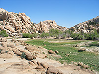
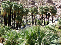
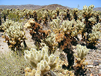
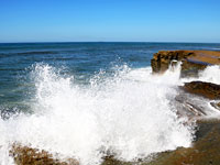
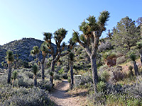
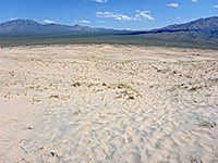
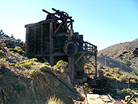
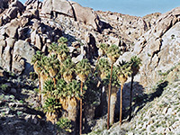
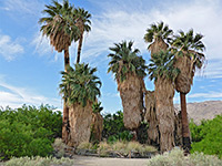
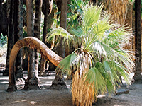
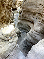
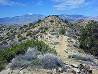
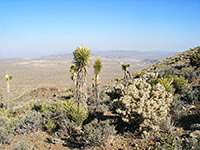
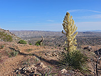
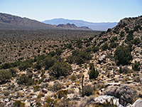
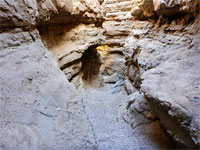
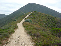
Anza-Borrego Desert State Park, Joshua Tree National Park and Mojave National Preserve are the three main hiking areas in south California, all containing exceptional desert scenery. Other locations include Palm Springs (the Indian Canyons) and Saddleback Butte State Park.
Map shows trailhead locations
| 1. Amboy Crater, Mojave National Preserve Length 1.7 miles (2.7 km) Elevation change 240 feet (73 meters) Difficulty Easy Rating (1-5) ★★★★★ Just outside Mojave National Preserve in the new Mojave Trails National Monument, this mostly level path crosses twisted lava formations to the summit of a cinder cone. |
| 2. Barker Dam, Joshua Tree National Park Length 1.2 miles (1.9 km); (loop) Elevation change 40 feet (12 meters) Difficulty Easy Rating (1-5) ★★★★★ Built by cattle ranchers at the end of the nineteenth century, Barker Dam is a small construction that in wet times holds back a pool in the granite boulders just inside the south edge of the Wonderland of Rocks. The loop hike past the pool also encounters plenty of Joshua trees, and a petroglyph panel (defaced by a film crew); it starts from a side road near the Hidden Valley campground. |
| 3. Big Morongo Canyon, Sand to Snow National Monument Length 4.3 miles (6.9 km) Elevation change 900 feet (274 meters) Difficulty Moderate - relatively long, and often very hot Rating (1-5) ★★★★★ Deep, winding ravine through the desert hills of the Little San Bernardino Mountains, with springs and dense undergrowth near the start, then mostly dry; followed by a wide path (the Canyon Trail), partly along an old vehicle track. |
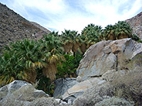
| 4. Borrego Palm Canyon, Anza Borrego Desert State Park Length 1.5 miles (2.4 km) Elevation change 500 feet (152 meters) Difficulty Easy Rating (1-5) ★★★★★ Popular trail up a ravine at the west edge of Borrego Valley, to a flourishing grove of California fan palms - the third largest oasis in the state. Many wildflowers in spring. |
| 5. Cholla Cactus Garden, Joshua Tree National Park Length 0.25 miles (0.4 km); (loop) Elevation change 0 feet (0 meters) Difficulty Easy Rating (1-5) ★★★★★ On the west side of Pinto Basin, the short Cholla Cactus Garden nature trail provides a close-up look at the densely-spined Opuntia Bigelovii (Teddy Bear Cholla), which in spring bears large, greenish white flowers. |
| 6. Coastal Trail, Cabrillo National Monument Length 0.5 miles (0.8 km) Elevation change 80 feet (24 meters) Difficulty Easy Rating (1-5) ★★★★★ Popular path across sandstone terraces on the Pacific side of Point Loma Peninsula, past cliffs, bluffs and tidepools. Also encounters varied plant life |
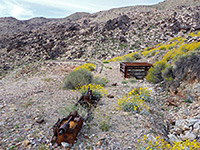
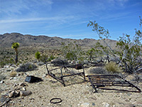
| 7. Contact Mine Trail, Joshua Tree National Park Length 1.8 miles (2.9 km) Elevation change 700 feet (213 meters) Difficulty Moderate Rating (1-5) ★★★★★ Mine relics including sealed shafts, spoil heaps and iron equipment, towards the upper end of a valley. Reached by an unmaintained trail, partly an old vehicle track, that leads up a sandy wash, beside a short ravine and over stony slopes. |
| 8. Culp Valley Trail, Anza Borrego Desert State Park Length 2.1 miles (3.4 km); (loop) Elevation change 200 feet (61 meters) Difficulty Easy Rating (1-5) ★★★★★ Loop past a spring and along a ridge to a fine viewpoint of Borrego Springs, 2,500 feet below. Also a good location for free primitive camping. |
| 9. Flat Top Butte, Sand to Snow National Monument Length 1.7 miles (2.7 km) Elevation change 200 feet (61 meters) Difficulty Easy Rating (1-5) ★★★★★ Broad mesa in a detached section of the national monument, below which are jumbled boulders with Joshua trees and many other desert plants, crossed by a scenic trail. Ancient petroglyphs can be found on some of the boulders. |
| 10. Fortynine Palms Oasis, Joshua Tree National Park Length 1.6 miles (2.6 km) Elevation change 300 feet (91 meters) Difficulty Moderate Rating (1-5) ★★★★★ This relatively easy and quite popular path climbs to the top of a barren ridge overlooking the town of Twentynine Palms then drops down to a sizeable group of California fan palms, growing at the junction of two rocky canyons. |
| 11. Gaviota Peak, Gaviota State Park Length 6.5 miles (10.5 km); (round trip) Elevation change 1950 feet (594 meters) Difficulty Moderate; steep in places and hot in summer, but no difficult terrain Rating (1-5) ★★★★★ 2,458 foot summit in the Santa Ynez Mountains, overlooking the Pacific coast west of Santa Barbara. Reached by two trails, together forming a loop; the steeper, more enclosed Gaviota Peak Trail and the slightly longer, more scenic Trespass Trail. |
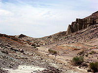
| 12. Hagen Canyon Trail, Red Rock Canyon State Park Length 1 mile (1.6 km); loop Elevation change 50 feet (15 meters) Difficulty Easy Rating (1-5) ★★★★★ Path along the northern end of a shallow valley lined with intricately eroded, multicolored cliffs, washes and mounds; the rocks are formed of various different strata in shades of red, white and grey, and are topped by a band of black lava, each layer having eroded in different ways. |
| 13. Harmony Headlands, Harmony Headlands State Park Length 2 miles (3.2 km) Elevation change 140 feet (43 meters) Difficulty Easy Rating (1-5) ★★★★★ The unspoilt Pacific coastline in Harmony Headlands State Park is reached by an easy trail along an old vehicle track, past treeless, grassy hills and down to the mostly rocky shore, which conceals a few sandy coves and is lined by colorful, eroded sandstone formations. |
| 14. Hellhole Canyon Trail, Anza Borrego Desert State Park Length 2.4 miles (3.9 km); to Maidenhair Falls; canyon can be followed further Elevation change 1300 feet (396 meters) Difficulty Moderate; more difficult past the falls Rating (1-5) ★★★★★ Path across open flats and into an increasingly rocky drainage, which contains several palm groves, an intermittent stream, a seasonal waterfall, and a good selection of wildflowers, |
| 15. High View Trail, Joshua Tree National Park Length 1.3 miles (2.1 km); round trip Elevation change 400 feet (122 meters) Difficulty Easy Rating (1-5) ★★★★★ Loop path that climbs into the foothills of the Little San Bernardino Mountains, giving good views of the Black Rock Canyon area in the northwest of the park; passes plenty of Joshua trees and many other desert plants. |
| 16. Kelso Dunes, Mojave National Preserve Length 1.5 miles (2.4 km) Elevation change 470 feet (143 meters) Difficulty Easy to moderate Rating (1-5) ★★★★★ The most accessible sand dunes in the Mojave Preserve are reached by an unpaved track, usually fine for all vehicles, that forks west off the Kelbaker Road, 8 miles south of Kelso. From a parking area at the side of the track, a short, well used trail sets off towards the sand, fading away near the edge, where visitors are free to climb the dunes and explore in any direction, though the usual target is the top of the tallest dune, about 1.5 miles from the road. |
| 17. Keys View, Joshua Tree National Park Length 0.2 miles (0.3 km); (loop) Elevation change 50 feet (15 meters) Difficulty Easy Rating (1-5) ★★★★★ At the end of the paved Keys View Road, a path climbs to the top of a small peak just to the south for a 360 degree panorama over the Little San Bernardino Mountains, and many places to the south. A longer path (half a mile) heads north from the parking area up to an even better viewpoint, on the top of a summit at 5,558 feet. |
| 18. Lake Tuendae, Mojave National Preserve Length 0.25 miles (0.4 km); (loop) Elevation change level feet (0 meters) Difficulty Easy Rating (1-5) ★★★★★ The western edge of the Mojave National Preserve is marked by a 4.8 mile partly paved road heading south from I-15 (exit 239), to the tiny settlement of Zzyzx - once the site of a health spa established in the 1940s, this is now used by the California State University as a desert study field center. The place was named in order to be the last word in any dictionary. The road ends at some springs beside an area of wetlands (Lake Tunedae), on the edge of the salt flats of the much larger Soda Lake. A short loop path beside the water's edge has information notices about the lake and the endangered Mojave tui chub fish which live there. |
| 19. Lost Horse Mine, Joshua Tree National Park Length 2 miles (3.2 km) Elevation change 480 feet (146 meters) Difficulty Easy to moderate Rating (1-5) ★★★★★ On the road to Keys View, a side track branches westwards ending after a mile at a small parking area at the edge of 5,178 foot Lost Horse Mountain, from where a trail (also once a vehicle track) ascends to the summit, en route passing several restored buildings from the Lost Horse Mine. One of these, the old ten-stamp mill, is particularly well preserved. Past the mine, a less used, unmaintained path continues along the mountain ridgetop for a while then descends a ravine and loops back to the start - total length 4 miles. |
| 20. Lost Palms Oasis, Joshua Tree National Park Length 4 miles (6.4 km) Elevation change 450 feet (137 meters) Difficulty Moderate Rating (1-5) ★★★★★ Perhaps the best day hike in Joshua Tree National Park, the route to the fan palm trees and pools at Lost Palms Oasis encounters rocky ridges, sandy washes, many Sonoran desert cacti and granite boulders, with frequent impressive views over the surrounding mountains. The trailhead is close to the southern entrance to the park, at Cottonwood Spring. |
| 21. Lucky Boy Vista Loop, Joshua Tree National Park Length 3.5 miles (5.6 km) Elevation change 170 feet (52 meters) Difficulty Easy to moderate Rating (1-5) ★★★★★ Traverse of flat land with occasional Joshua trees to a viewpoint and old mine site, returning via two shallow drainages, past clumps of boulders, low cliffs and scattered pine trees |
| 22. Mountain Palm Springs, Anza Borrego Desert State Park Length 3.5 miles (5.6 km); loop, in total Elevation change 200 feet (61 meters) Difficulty Easy Rating (1-5) ★★★★★ Six groves of California fan palms, in four adjacent ravines at the edge of Carrizo Valley - surrounded by low elevation desert, very hot in summer. |
| 23. Oasis of Mara Trail, Joshua Tree National Park Length 0.5 miles (0.8 km); (loop) Elevation change 0 feet (0 meters) Difficulty Easy Rating (1-5) ★★★★★ At the main Oasis Visitor Center in Twentynine Palms, a paved path reaches the most accessible of Joshua Tree's six California fan palm oases, though also the least natural, as the surroundings are relatively well developed. |
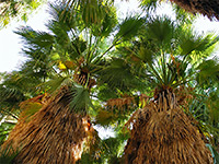
| 24. Palm Canyon Trail, Palm Springs Length 1.2 miles (1.9 km); to the uppermost palms Elevation change 200 feet (61 meters) Difficulty Easy Rating (1-5) ★★★★★ Enchanting path up a rocky ravine with a permanent stream, home to the world's largest oasis of California fan palms. Surrounding the cool, most environment along the valley floor are arid slopes bearing cholla and barrel cacti. |
| 25. Palm Wash; Middle Fork, Main Branch Length 2 miles (3.2 km) Elevation change 550 feet (168 meters) Difficulty Moderate Rating (1-5) ★★★★★ Longest enclosed section of the various branches of Palm Wash, with some quite deep and narrow passageways, containing several chokestones and dryfalls. Cuts through layered, grey or brown rocks. Ends close to Calcite Mine. |
| 26. Palm Wash; Middle Fork, South Branch Length 1.6 miles (2.6 km) Elevation change 360 feet (110 meters) Difficulty Easy Rating (1-5) ★★★★★ Short but pretty narrows section starting just upstream of the crossing of the jeep track to Calcite Mine; sinuous curves and a floor of bare rock, The canyon soon widens, leading to a high dryfall. |
| 27. Palm Wash; South Fork Length 2 miles (3.2 km) Elevation change 200 feet (61 meters) Difficulty Easy Rating (1-5) ★★★★★ Shallow slot canyon through grey-brown conglomerate rocks surrounded by desert badlands, towards the low elevation east side of Anza Borrego Desert State Park |
| 28. Panorama Trail, Joshua Tree National Park Length 8.6 miles (13.8 km); (loop, including the two spur trails) Elevation change 1070 feet (326 meters) Difficulty Moderate Rating (1-5) ★★★★★ The Panorama Trail affords wide ranging views of the Little San Bernadino Mountains, passing Joshua trees at the start (near the Black Rock Canyon campground), then pinyon/juniper pine at higher elevations. Two side trails branch off; to 5,103 foot Warren Peak, and to a similar, nearby viewpoint. |
| 29. Pine City and Desert Queen Mine, Joshua Tree National Park Length 4.4 miles (7.1 km) Elevation change 350 feet (107 meters) Difficulty Moderate Rating (1-5) ★★★★★ Varied loop, off-trail for a short section, past two groups of old mine relics, along a canyon and across open flats to a shallow basin with huge boulders and pine trees. The basin is good for exploring; other sites in the vicinity include an old townsite and a spring |
| 30. Pinto Mountain, Joshua Tree National Park Length 4.5 miles (7.2 km) Elevation change 2200 feet (671 meters) Difficulty Moderate to strenuous Rating (1-5) ★★★★★ Isolated, 3,983 foot summit in the north-central area of the park, overlooking the vast, sandy flatlands of Pinto Basin, reached by a mostly off-trail hike across sandy flats and up a rocky ravine. Views from the top span an uninterrupted 360 degrees, as there are no higher points close by. |
| 31. Plum Canyon, Anza Borrego Desert State Park Length 4 miles (6.4 km); loop Elevation change 800 feet (244 meters) Difficulty Strenuous Rating (1-5) ★★★★★ Shallow but rather steep drainage in the North Pinyon Mountains. The north fork is followed by a trail, while a loop can be made via the south fork, along a partially off-trail route |
| 32. Queen Mountain, Joshua Tree National Park Length 2 miles (3.2 km) Elevation change 1100 feet (335 meters) Difficulty Strenuous Rating (1-5) ★★★★★ From the end of a side road across Queen Valley, a little-used trail climbs the steep southern slope of Queen Mountain, ending at an elevated viewpoint near the summit - one of the highest peaks in the park. |
| 33. Rattlesnake Canyon, Joshua Tree National Park Length 1.2 miles (1.9 km); to where the canyon becomes blocked by large boulders Elevation change 400 feet (122 meters) Difficulty Easy to moderate Rating (1-5) ★★★★★ A faint path enters the lower end of Rattlesnake Canyon, near the Indian Cove campground, and follows the narrow drainage into the north section of the Wonderland of Rocks, offering a quick introduction to this scenic area. |
| 34. Rings Trail, Mojave National Preserve Length 1.4 miles (2.3 km); (loop) Elevation change 70 feet (21 meters) Difficulty Easy Rating (1-5) ★★★★★ The Rings Trail descends through a short slot-like ravine (Banshee Canyon) at the edge of the hills close to the Hole-in-the-Wall campground, assisted in two of the steeper parts by ringbolts fastened to the smooth, water-polished canyon walls. The starting point is at the end of a short side road to a picnic area, 0.2 miles north of the Hole-in-the-Wall information center. |
| 35. Rock Spring Loop, Mojave National Preserve Length 1 mile (1.6 km); (loop) Elevation change 120 feet (37 meters) Difficulty Easy Rating (1-5) ★★★★★ This recently constructed (2009) trail starts beside a historic stone cabin, crosses grassy terrain to the edge of a boulder-filled ravine then follows this downstream a short distance to a seasonal pool, or a flowing creek during occasional wet periods. More pools can be seen by scrambling up the ravine. The return part of the loop is over open, undulating desert. |
| 36. Ryan Mountain, Joshua Tree National Park Length 1.5 miles (2.4 km) Elevation change 1060 feet (323 meters) Difficulty Moderate Rating (1-5) ★★★★★ Ryan Mountain is a somewhat isolated yet easily reached peak surrounded by open plains so the views from its summit are some of the best in the park. The well used path to the top begins at a parking area along the main road, a mile west of the turn-off for the Sheep Pass group campground, and climbs steadily up the slopes, passing scattered vegetation of Joshua trees at first then pinyon/juniper pine at higher elevations. |
| 37. Saddleback Butte Trail, Saddleback Butte State Park Length 2 miles (3.2 km) Elevation change 950 feet (290 meters) Difficulty Moderate Rating (1-5) ★★★★★ Saddleback Butte is an isolated summit near the edge of the Mojave Desert, sustaining a forest of Joshua trees on its lower slopes. A rewarding trail climbs to the summit, which gives a fabulous 360 degree view of the surrounding valley, a panorama extending to 50 miles in some directions. |
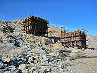
| 38. Silver Bell and El Dorado Mines, Joshua Tree National Park Length 4 miles (6.4 km); (loop) Elevation change 250 feet (76 meters) Difficulty Moderate; cross-country navigation, some steep slopes Rating (1-5) ★★★★★ Two mines in the Hexie Mountains, one including two well preserved wooden tipples; both have shafts, adits, foundations, tanks and other remains. Hike also has good views and encounters a variety of cacti. |
| 39. South Park Peak Trail, Joshua Tree National Park Length 0.6 miles (1 km); round trip Elevation change 230 feet (70 meters) Difficulty Easy Rating (1-5) ★★★★★ Loop path, just outside the park boundary, that climbs a shallow ravine to a minor summit overlooking the town of Yucca Valley; also has good views over the Black Rock Canyon area to the south. |
| 40. Split Mountain Trail, Anza Borrego Desert State Park Length 3.1 miles (5 km); to the Wind Caves Elevation change 150 feet (46 meters) Difficulty Moderate Rating (1-5) ★★★★★ Fairly level route along a narrow canyon formed by Fish Creek, cutting through angled, metamorphic strata, and on to some eroded rock formations (the Wind Caves) at the edge of the Carrizo Badlands. |
| 41. Teutonia Peak, Mojave National Preserve Length 2 miles (3.2 km) Elevation change 700 feet (213 meters) Difficulty Moderate Rating (1-5) ★★★★★ Starting from a layby along Cima Road, the trail to Teutonia Peak passes a Joshua tree forest and an old silver mine then climbs a narrow ridge to a granitic summit that affords nice views over the surrounding desert and mountains. |
| 42. The Slot Length 0.4 miles (0.6 km) Elevation change 50 feet (15 meters) Difficulty Easy Rating (1-5) ★★★★★ The Slot is a minor drainage in the Borrego Mountains, reached by a dirt track, and notable for about half a mile of quite pretty narrow passages through grey-brown conglomerate rocks. |
| 43. Thimble Trail, Anza Borrego Desert State Park Length 3.5 miles (5.6 km); to Mal Pais Vista Elevation change 100 feet (30 meters) Difficulty Easy Rating (1-5) ★★★★★ Undulating route through the northern reaches of the Borrego Badlands - extensive views of the stark desert surroundings. |
| 44. Tubb Canyon Trail, Anza Borrego Desert State Park Length 0.9 miles (1.4 km) Elevation change 120 feet (37 meters) Difficulty Easy Rating (1-5) ★★★★★ Path over grassy flats, a dry wash and a limestone ridge, ending at a permanent spring that sustains a few palm trees and many wildflower species. |
| 45. Valencia Peak Trail, Montaña de Oro State Park Length 1.9 miles (3.1 km) Elevation change 1290 feet (393 meters) Difficulty Easy to moderate Rating (1-5) ★★★★★ Hike up open slopes to a 1,347 foot summit just over one mile from the Pacific Ocean, giving good views up and down the coast, and inland over many more rolling, grassy hills. |
| 46. Wonderland Wash, Joshua Tree National Park Length 1 mile (1.6 km) Elevation change 0 feet (0 meters) Difficulty Easy Rating (1-5) ★★★★★ Starting at the same trailhead for Barker Dam, a well trodden path heads a little further north then follows a wide, sandy wash into the south edge of the Wonderland of Rocks. There are limitless opportunities for off trail exploration, both for regular hiking and rock climbing. |
All Contents © Copyright The American Southwest | Comments and Questions | Contribute | Affiliate Marketing Disclosure | Site Map

