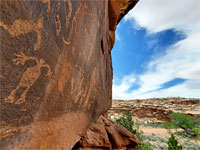
Kane Creek Road
Scenic backroad southwest of Moab, alongside the Colorado River for 3 miles then, now unpaved, ascending the side canyon of Kane Springs Creek, past petroglyphs and rock formations
Length: various short hikes, up to 0.4 miles
Difficulty: Easy (moderate for Funnel Arch)
Usage: Medium, for the hikes
Season: All year
Trailheads: Moonflower Canyon, Kings Bottom bench, Amasa Back, Birthing Rock, Funnel Arch
Rating (1-5): ★★★★★
Difficulty: Easy (moderate for Funnel Arch)
Usage: Medium, for the hikes
Season: All year
Trailheads: Moonflower Canyon, Kings Bottom bench, Amasa Back, Birthing Rock, Funnel Arch
Rating (1-5): ★★★★★
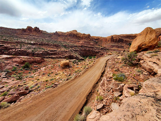
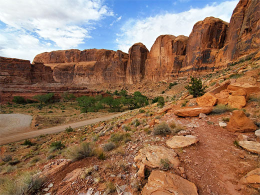
The three roads follow the Colorado River away from Moab, all very scenic - Hwy 128 upstream to the east, past Castle Valley and the Fisher Towers, and, in the other direction, Potash Road along the north side of the river and Kane Creek Road (also known as Kane Springs Road) to the south. This route is paved for the first 3 miles, becoming unpaved as it enters the major side canyon of Kane Springs Creek, and it gives access to a huge area of the backcountry, all very popular, for various kinds of recreation.
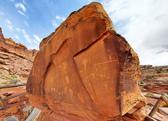
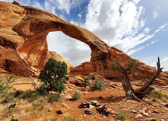
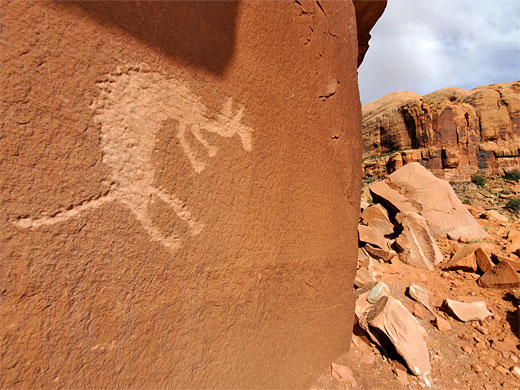
Described here are a number of sites along the first 5 miles of the route, starting from the mouth of the Colorado River canyon, west of Moab city center. One of the main attractions hereabouts is rock art; many petroglyphs are inscribed on the rocks beside the river and along the side canyon, most famous being a free-standing boulder with effigies including a birthing scene. Other highlights along this section of the road include Moonflower Canyon, a riparian ravine, and Funnel Arch, reached by short, steep climb up from the road.
To explore Moonflower Canyon, visit seven petroglyph sites, and climb to Funnel Arch would take around half a day, maybe a little more.
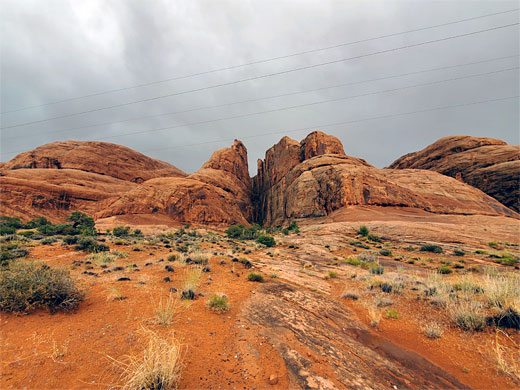
42 views along Kane Creek Road.
Colorado River at the Portal, petroglyphs at Birthing Rock, and Funnel Arch.
Map of Kane Creek Road, and the Moab area.
Rocks along Kane Creek Road are sandstone, generally dull red to brown in color. The road from town crosses a flat area then enters the canyon enclosing the Colorado River, at an opposing pair of cliffs known as the Portal. Here, Wingate sandstone is briefly exposed, soon replaced by the Kayenta Formation as far as Moonflower Canyon, followed by Navajo Sandstone nearly all the way to the confluence with Kane Springs Canyon, after which the Kayenta reappears.
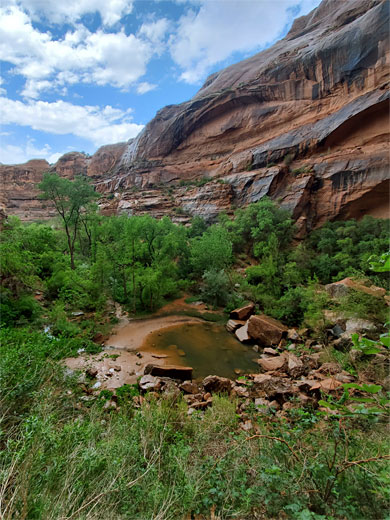
The road starts as Kane Creek Boulevard, forking west off US 191 towards the south side of central Moab; a busy route, with heavy ATV traffic. It crosses a residential district and a brief strip of undeveloped land then reaches the Colorado, curving south and entering the river canyon. The first site of note is the parking place for the Moab Rim Trail, a 4WD route that climbs a sloping bench and leads to several places on the plateau above, including the upper end of Hidden Valley. Not far beyond, on the opposite side of the road, is Kings Bottom Campground, a BLM facility accommodating tents and small RVs. A quarter of a mile further, the road passes a sandy parking area at the head of Moonflower Canyon, from where a path (0.4 miles, 160 feet) leads along the drainage to a pool at the upper end. There are petroglyphs on the cliffs at its entrance, on south side, facing the main road.
South of Moonflower Canyon, Kane Springs Road is bordered by a line of straight cliffs around 50 feet high, with a narrow strip of flat land at the base, some parts seemingly privately owned, since semi-permanent caravans are installed, some accompanied by hollowed-out cavities in the rocks, used as storage; untidy-looking places. The character of this area is set to change following approval to construct a new development at Kings Bottom, a broad strip of low-lying land between the road and the river; the plans call for nearly 600 homes and 72,000 square feet of commercial property. All of this land is a floodplain so the project includes raising the entire area by up to ten feet, to mitigate the flood risk.
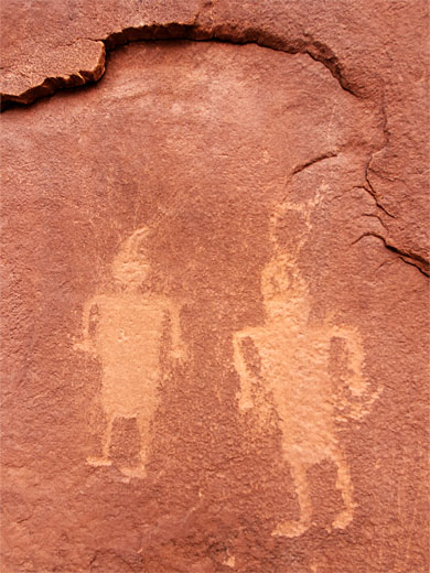
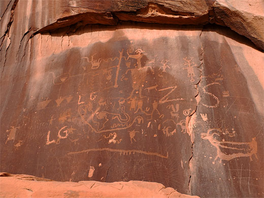
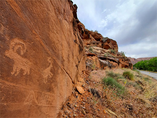
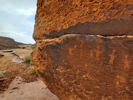
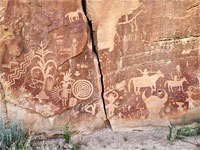
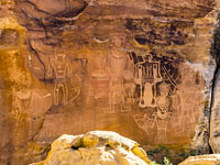
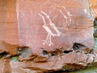
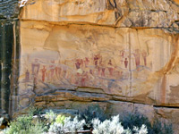
Between Moonflower Canyon and Kane Springs Creek, where the road leaves the river, are several other petroglyph sites, some beside the road at the foot of the cliffs, others a little further east; above the roadside cliffs is a sandy bench, and then taller cliffs, split by many short, vertical-walled ravines, also with some rock art. One site is 1600 feet south of Moonflower, at a small, raised area perhaps with a caravan, and just behind a telegraph pole - a large, fallen boulder covered with dozens of petroglyphs, many rather faint, mixed with signatures and modern graffiti, while above, on the adjacent cliff, are more, better designs, generally clean and crisp. 3000 feet south is a small panel with two bighorn sheep, and then, 1800 feet further, a larger grouping, also at the base of a cliff. These latter two panels are just a few feet from the road. The main access to the bench above the lower cliffs is via a track that climbs to a parking place at the mouth of a little valley then continues, now rougher, northwards, giving access to several small petroglyph panels, none particularly exciting - seen on a walk of around 0.4 miles.
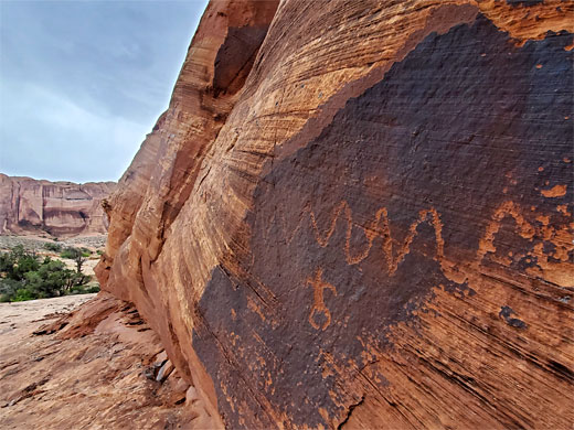
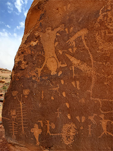
After Kings Bottom, Kane Springs Road passes the lower end of Pritchett Canyon and turns away from Colorado River, entering the larger Kane Springs Canyon. The next rock art site is 0.6 miles along here, reached from the railing-enclosed parking area for the Amasa Back Trailhead; the petroglyphs are at the base of a protruding section of the cliff to the east, atop a boulder-covered slope, some directly opposite the road, others a little further east. One panel is known as the false kiva petroglyphs. The next rock art site, the most spectacular along the road, is in another 0.6 miles, after the route has climbed by around 200 feet, this is the birthing rock, a conspicuous, isolated boulder on the west side of the road, protected by a wooden fence, with petroglyphs all around. A pullout just above has space for a few vehicles to park.
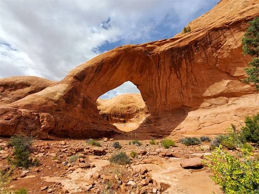
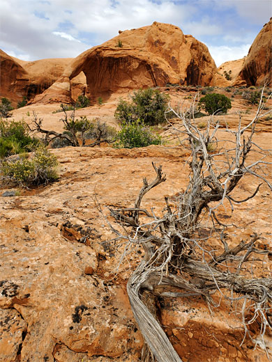
1700 feet past the birthing rock is another unsigned parking place, the trailhead for the short hike to Funnel Arch - 0.3 miles, climbing 270 feet. The route, not marked and not always obvious, is due north, up a low cliff to a bench and into a short ravine, climbing a near vertical slope of around 10 to 15 feet at one point, to a flat area below more cliffs, then turning east, upstream along a drainage, through some bushes and out to a big sandy flat, ringed by cliffs; the arch is now visible ahead. The span is also known as Cable Arch, apparently because a cable was once installed at one side, allowing hikers to ascend to the top.
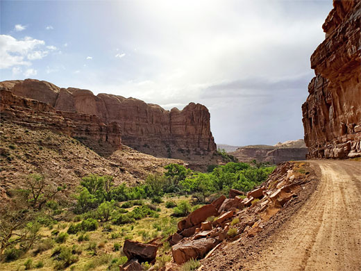
After the Funnel Arch trailhead, Kane Springs Road winds through a few more bends, still generally fine for most vehicles, past a side drainage (Hunter Canyon) then, after 5 miles from the Colorado, the cliffs abruptly recede, and the canyon becomes very wide. All around are other tracks, viewpoints, arches, rock formations, and petroglyphs enough many days of exploring.
Described here are a number of sites along the first 5 miles of the route, starting from the mouth of the Colorado River canyon, west of Moab city center. One of the main attractions hereabouts is rock art; many petroglyphs are inscribed on the rocks beside the river and along the side canyon, most famous being a free-standing boulder with effigies including a birthing scene. Other highlights along this section of the road include Moonflower Canyon, a riparian ravine, and Funnel Arch, reached by short, steep climb up from the road.
To explore Moonflower Canyon, visit seven petroglyph sites, and climb to Funnel Arch would take around half a day, maybe a little more.
Photographs
42 views along Kane Creek Road.
Kane Creek Road Video
Colorado River at the Portal, petroglyphs at Birthing Rock, and Funnel Arch.
Location
Map of Kane Creek Road, and the Moab area.
Geology
Rocks along Kane Creek Road are sandstone, generally dull red to brown in color. The road from town crosses a flat area then enters the canyon enclosing the Colorado River, at an opposing pair of cliffs known as the Portal. Here, Wingate sandstone is briefly exposed, soon replaced by the Kayenta Formation as far as Moonflower Canyon, followed by Navajo Sandstone nearly all the way to the confluence with Kane Springs Canyon, after which the Kayenta reappears.
Moab Rim Trail and Moonflower Canyon
The road starts as Kane Creek Boulevard, forking west off US 191 towards the south side of central Moab; a busy route, with heavy ATV traffic. It crosses a residential district and a brief strip of undeveloped land then reaches the Colorado, curving south and entering the river canyon. The first site of note is the parking place for the Moab Rim Trail, a 4WD route that climbs a sloping bench and leads to several places on the plateau above, including the upper end of Hidden Valley. Not far beyond, on the opposite side of the road, is Kings Bottom Campground, a BLM facility accommodating tents and small RVs. A quarter of a mile further, the road passes a sandy parking area at the head of Moonflower Canyon, from where a path (0.4 miles, 160 feet) leads along the drainage to a pool at the upper end. There are petroglyphs on the cliffs at its entrance, on south side, facing the main road.
Kings Bottom
South of Moonflower Canyon, Kane Springs Road is bordered by a line of straight cliffs around 50 feet high, with a narrow strip of flat land at the base, some parts seemingly privately owned, since semi-permanent caravans are installed, some accompanied by hollowed-out cavities in the rocks, used as storage; untidy-looking places. The character of this area is set to change following approval to construct a new development at Kings Bottom, a broad strip of low-lying land between the road and the river; the plans call for nearly 600 homes and 72,000 square feet of commercial property. All of this land is a floodplain so the project includes raising the entire area by up to ten feet, to mitigate the flood risk.
Colorado River Petroglyphs
Between Moonflower Canyon and Kane Springs Creek, where the road leaves the river, are several other petroglyph sites, some beside the road at the foot of the cliffs, others a little further east; above the roadside cliffs is a sandy bench, and then taller cliffs, split by many short, vertical-walled ravines, also with some rock art. One site is 1600 feet south of Moonflower, at a small, raised area perhaps with a caravan, and just behind a telegraph pole - a large, fallen boulder covered with dozens of petroglyphs, many rather faint, mixed with signatures and modern graffiti, while above, on the adjacent cliff, are more, better designs, generally clean and crisp. 3000 feet south is a small panel with two bighorn sheep, and then, 1800 feet further, a larger grouping, also at the base of a cliff. These latter two panels are just a few feet from the road. The main access to the bench above the lower cliffs is via a track that climbs to a parking place at the mouth of a little valley then continues, now rougher, northwards, giving access to several small petroglyph panels, none particularly exciting - seen on a walk of around 0.4 miles.
Kane Springs Canyon Petroglyphs
After Kings Bottom, Kane Springs Road passes the lower end of Pritchett Canyon and turns away from Colorado River, entering the larger Kane Springs Canyon. The next rock art site is 0.6 miles along here, reached from the railing-enclosed parking area for the Amasa Back Trailhead; the petroglyphs are at the base of a protruding section of the cliff to the east, atop a boulder-covered slope, some directly opposite the road, others a little further east. One panel is known as the false kiva petroglyphs. The next rock art site, the most spectacular along the road, is in another 0.6 miles, after the route has climbed by around 200 feet, this is the birthing rock, a conspicuous, isolated boulder on the west side of the road, protected by a wooden fence, with petroglyphs all around. A pullout just above has space for a few vehicles to park.
Funnel Arch
1700 feet past the birthing rock is another unsigned parking place, the trailhead for the short hike to Funnel Arch - 0.3 miles, climbing 270 feet. The route, not marked and not always obvious, is due north, up a low cliff to a bench and into a short ravine, climbing a near vertical slope of around 10 to 15 feet at one point, to a flat area below more cliffs, then turning east, upstream along a drainage, through some bushes and out to a big sandy flat, ringed by cliffs; the arch is now visible ahead. The span is also known as Cable Arch, apparently because a cable was once installed at one side, allowing hikers to ascend to the top.
Backcountry
After the Funnel Arch trailhead, Kane Springs Road winds through a few more bends, still generally fine for most vehicles, past a side drainage (Hunter Canyon) then, after 5 miles from the Colorado, the cliffs abruptly recede, and the canyon becomes very wide. All around are other tracks, viewpoints, arches, rock formations, and petroglyphs enough many days of exploring.
Kane Creek Road Wildflower
 Rimrock milkvetch |
Kane Creek Road - Similar Places
All Contents © Copyright The American Southwest | Comments and Questions | Contribute | Affiliate Marketing Disclosure | Site Map
