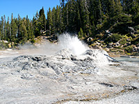
Hiking in Yellowstone National Park - the Southwest
Wyoming > Yellowstone National Park > The Southwest > Hiking
Southwest Yellowstone Trails: Day Hikes | Backcountry Hikes
The Yellowstone hiking map indicates the location of each trail.
All paths in Yellowstone: North, East, Southeast, Southwest, Northwest.
Southwest Yellowstone National Park Trails - Day Hikes, mostly around the Upper, Midway and Lower Geyser Basins
|
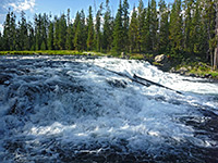
Bechler Falls Length 1.3 miles (2.1 km) Elevation change 60 feet (18 meters) Trailhead Parking area at Cave Falls Rating (1-5) ★★★★★ This short hike follows the southernmost section of the Bechler River Trail starting at Cave Falls, past the Bechler River-Falls River confluence to Bechler Falls, a small waterfall but still quite powerful. The trailhead is at the end of Cave Falls Road, in the remote southwest corner of the park. |
|
Biscuit Basin Length 0.4 miles (0.6 km) (loop) Elevation change level Trailhead Parking area just off the main road Rating (1-5) ★★★★★ Biscuit Basin contains a group of small geysers and springs next to the highway, at the north edge of the Upper Geyser Basin. The loop trail passes all main features, and links with longer hikes to Mystic Falls, Fairy Creek and Summit Lake. |
|
Black Sand Basin Length 0.3 miles (0.5 km) (loop) Elevation change level Trailhead Parking area just off the main road Rating (1-5) ★★★★★ On the west side of the highway near Old Faithful, Black Sand Basin contains five large geysers and pools plus other smaller features, viewable from a short, branched footpath. |
|
Divide Lookout Length 1.5 miles (2.4 km) Elevation change 740 feet (226 meters) Trailhead South side of US 20/191/287, one mile west of the continental divide Rating (1-5) ★★★★★ Beginning on the main road 7 miles east of Old Faithful, this short, unmarked trail climbs up a steep, wooded ravine to a summit on the continental divide, at 8,779 feet. Along the way are good views over the southwest of the national park, including Shoshone Lake and Mount Sheridan. |
|
Fairy Falls Length 2.4 miles (3.9 km) 3 miles to the geysers Elevation change level Trailhead South end of Fountain Flats Drive Rating (1-5) ★★★★★ At Fairy Falls, Fairy Creek cascades 200 feet down the edge of Madison Plateau then flows northwards across marshy ground into the Lower Geyser Basin. The easiest way to reach the falls is from a trail that starts at the end of a very short side road leading to a footbridge over the Firehole River, a mile south of Midway Geyser Basin - this is the south end of an old vehicle track that links with the main road again at Fountain Flats after 4.5 miles, and provides alternative access to the falls from the north. This level track follows the side of the valley for a mile, past Grand Prismatic Spring to a junction with a narrower path that heads west to Fairy Falls, and links with the Fairy Creek Trail to reach several nearby geysers. |
|
Fern Cascades Length 3 miles (4.8 km) (loop) Elevation change 400 feet (122 meters) Trailhead West parking lot at Old Faithful Rating (1-5) ★★★★★ Iron Spring Creek flows from the forested hills southwest of Old Faithful then on through Black Sand Geyser Basin. Near the edge of the woods it tumbles down a steep incline over the Fern Cascades, not the grandest of Yellowstone's waterfalls but popular as it is just 1 mile from the highway. The trail continues through the woods and back to the road to form a 3 mile loop. |
| Tours of Southwest Yellowstone |
|
Fountain Paint Pots Length 0.5 miles (0.8 km) (loop) Elevation change level Trailhead Large parking area beside the main road Rating (1-5) ★★★★★ Several dozen hot pools, mudpots, fumaroles and geysers are found along this short path near the Firehole Lake Drive in the Lower Geyser Basin. |
|
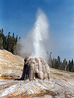
Lone Star Geyser Length 2.5 miles (4 km) Elevation change 60 feet (18 meters) Trailhead Short spur road on the west side of the highway Rating (1-5) ★★★★★ The most accessible backcountry geyser basin in Yellowstone - centered around Lone Star Geyser - is reached by an easy trail that follows an old service road through undamaged forest beside the Firehole River, starting at the parking area for the Kepler Cascades. |
|
Mallard Creek Length 4 miles (6.4 km) Elevation change 920 feet (280 meters) Trailhead Pullout on the east side of the main road Rating (1-5) ★★★★★ This little used and now unmaintained route follows close to Mallard Creek for 4 miles, starting from the highway near the confluence with the Firehole River, to a junction with the Mallard Lake Trail. The creek flows down quite a steep, narrow ravine, and most of the path is across hillsides a little way above. The two paths to Mallard Lake can be combined with trails parallel to the road to form a loop hike of 11 miles. |
|
Mallard Lake Length 3 miles (4.8 km) Elevation change 660 feet (201 meters) Trailhead Near the east parking lot at Old Faithful Rating (1-5) ★★★★★ The relatively popular trail to Mallard Lake starts on the east side of the Old Faithful visitor complex by crossing the Firehole River on a footbridge then begins a steady ascent up a narrow ravine through pine forest partly burned in 1988. A stream running close to the trail flows past a number of hot pools and mudpots after about half a mile. Above the ravine is a rather steeper climb to flat-topped ridge, and a junction with the Mallard Creek Trail. The lake is a short distance further, down a slope. |
|
Midway Geyser Basin Length 0.5 miles (0.8 km) (loop) Elevation change 40 feet (12 meters) Trailhead Large parking area beside the main road Rating (1-5) ★★★★★ The smallest of the three geyser basins along the Firehole River is viewed from a short boardwalk trail that crosses the river then loops around Grand Prismatic Spring and Excelsior Geyser. |
|
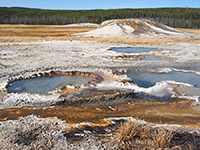
Morning Mist Springs and the Quagmire Group Length 2.5 miles (4 km) round trip Elevation change 250 feet (76 meters) Trailhead Pullout on the east side of the highway, at the edge of Fountain Flats Rating (1-5) ★★★★★ Loop hike, partly off trail, to two backcountry thermal areas of the Lower Geyser Basin; a group of small pools in open grassland near Nez Perce Creek, and a more secluded collection of larger springs, beneath a wooded hillside. |
|
Mystic Falls Length 1.2 miles (1.9 km) Elevation change 150 feet (46 meters) Trailhead Biscuit Basin Rating (1-5) ★★★★★ Mystic Falls is a cascade on the Little Firehole River, where the waters drop 70 feet within a narrow ravine, shortly before joining the main river, and can be reached by an easy spur path that branches off the southern end of the Fairy Creek Trail. Starting at the edge of Biscuit Basin, the route is to follow the path heading west towards the forest, past one junction, fork left at the next junction (right is to Fairy Creek) and right at the third junction (left is to Summit Lake); this trail soon enters the ravine and passes the falls, 1.2 miles from the start. The path continues by climbing another 350 feet up the hillside and rejoining the Fairy Creek Trail. Turning right leads to an overlook of Biscuit Basin before descending back towards the starting point, a total loop of about 3 miles. |
|
Observation Point Length 1.1 miles (1.8 km) (loop) Elevation change 160 feet (49 meters) Trailhead Near Old Faithful Rating (1-5) ★★★★★ The Observation Point loop trail branches off the main path through the Upper Geyser Basin, climbs a short, steep, wooded hillside to a viewpoint of Old Faithful and nearby features, then continues across the hill to Solitary Geyser, a bubbling pool in an open area of the forest. |
|
Sentinel Meadows Length 2.2 miles (3.5 km) Elevation change 40 feet (12 meters) Trailhead End of the north section of Fountain Flats Road Rating (1-5) ★★★★★ At the north edge of the Lower Geyser Basin, Sentinel Meadows offers a quick hike to a backcountry thermal region, containing geyser cones and a selection of hot pools of varying sizes. The trail begins at the end of the Fountain Flats road, crosses the Firehole River and follows Sentinel Creek westwards into the meadows. |
|
Spring Creek Length 3.5 miles (5.6 km) Elevation change 360 feet (110 meters) Trailhead 1.5 miles along Lone Star Geyser Trail Rating (1-5) ★★★★★ The trail through pine woods along Spring Creek was once an old wagon track so now provides an easy walk beside the spring-fed stream, without passing any points of particular interest. It receives most use as a ski trail in winter. The west end is 1.5 miles along the Lone Star Geyser/Shoshone Lake trail, and the east end is near the main road 7 miles from Old Faithful - a short distance along the Divide Lookout Trail. |
|
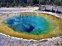
Upper Geyser Basin Length 2.5 miles (4 km) Elevation change 80 feet (24 meters) Trailhead Old Faithful Rating (1-5) ★★★★★ Not everyone walks the full length of the path through the Upper Geyser Basin, but the lower end is the most used trail in the park. From Old Faithful Inn, the flat, paved path follows alongside the Firehole River through the greatest concentration of geysers in the world. Short side trails lead to particular groups, and one longer diversion (Observation Point Trail) heads up into the hills. After Morning Glory Pool (1.5 miles), the path enters the forest for half a mile, but reaches more geysers (the Cascade Group) when it returns to the river. |
Southwest Yellowstone National Park Trails - Backcountry Hikes
|
Bechler River Length 21 miles (33.8 km) Elevation change 2050 feet (625 meters) Trailhead Parking area at Cave Falls Rating (1-5) ★★★★★ The far southwest corner of Yellowstone is a roadless land of mountains, meadows, rivers and especially waterfalls, with over 20 major falls and cascades along the Bechler River and its tributaries. There are only occasional thermal features but still this is the premier area for backpacking in the park, and the main cross-country route is the Bechler River Trail. This runs from the ranger station by the remote southwest entrance, across several miles of wide meadowland beside the river, up a long narrow canyon containing many of the best waterfalls, over the southeast corner of the Madison Plateau, and down into the valley of Shoshone Creek, where the river route joins the Shoshone Lake Trail, 6 miles from its northern trailhead at the Kepler Cascades. |
|
Beula Lake Length 2.5 miles (4 km) Elevation change 200 feet (61 meters) Trailhead Along Grassy Lake Road Rating (1-5) ★★★★★ The trail to Beula Lake starts outside the national park along FR 152, next to Grassy Lake Reservoir. The path climbs a hillside, crosses the South Boundary Trail, then is mostly level as it follows a low ridge to the lake - not an especially interesting hike but a good choice for peace and solitude. |
|
Boundary Creek Length 8.4 miles (13.5 km) to Dunanda Falls Elevation change 350 feet (107 meters) Trailhead Bechler River ranger station Rating (1-5) ★★★★★ Boundary Creek is a tributary of the Bechler River on which are found 2 major waterfalls. From the Bechler River ranger station, a trail passes through flat forest and meadowland for 8 miles to the edge of a plateau, where the creek enters a ravine and flows over 150 foot Dunanda Falls. A nearby side canyon contains the 250 foot Silver Scarf Falls. Above the falls, the path continues further up Boundary Creek Canyon to the west boundary of the national park. |
|
De Lacy Creek Length 6.5 miles (10.5 km) Elevation change 200 feet (61 meters) Trailhead Parking area on the north side of the main road Rating (1-5) ★★★★★ The popular De Lacy Creek Trail provides the shortest route to Shoshone Lake, reaching the northern shores after an easy 3 mile walk alongside the creek, through meadowland that is filled with wildflowers in summer and is often visited by moose. At lakeside a lesser-used path branches off to the west, leading to Shoshone Geyser Basin after 7 miles, while the main route continues along the steep-sided east edge of the lake to its outlet at the Lewis River. |
|
Fairy Creek Length 13 miles (20.9 km) Elevation change 1000 feet (305 meters) Trailhead North end of Fountain Flats Road Rating (1-5) ★★★★★ The northern section of the Fairy Creek Trail links the Lower and Midway geyser basins, and passes a number of thermal features including Fairy Springs, Imperial Geyser and Spray Geyser. The path begins at the end of the paved part of the Fountain Flats road, and follows the creek southward across marshy meadows and patches of forest heavily damaged in the 1988 fires, past junctions with the trails to Sentinel Meadows and Fairy Falls. The route is much less traveled beyond the two geysers, where it climbs quite steeply up to Madison Plateau, traverses flat land for a few miles then descends briefly into the canyon of the Little Firehole River, later climbing above the river, past Mystic Falls and down into Biscuit Basin. |
|
Lewis Channel Length 6 miles (9.7 km) Elevation change 120 feet (37 meters) Trailhead Along the main road north of Lewis Lake Rating (1-5) ★★★★★ This is a connecting path between the south entrance road and Shoshone Lake, and also loops around the north shore of Lewis Lake. The route starts on the road just north of Lewis Lake (next to the east end of the Shoshone Lake Trail), and first encounters marshy land around the lakeshore before turning away north alongside the Lewis River. |
|
Mary Mountain Length 21 miles (33.8 km) Elevation change 1100 feet (335 meters) Trailhead Beside Alum Creek, Hayden Valley Rating (1-5) ★★★★★ Only one trail crosses the Central Plateau in the middle of Yellowstone National Park, a varied region with scattered thermal features, mountains, lakes and much wildlife along the valleys. Most of the route of the Mary Mountain Trail is along the course of two creeks - Nez Perce in the west and Alum Creek (Hayden Valley) in the east, both of which are prime locations for bison, and grizzly bears. Separating the two valleys is the high ground of Mary Mountain, a flat, wooded summit where the path passes a few gas vents and hot springs. More pools are found at the western end of the route (the Quagmire and Morning Mist Springs groups). Because of the abundant wildlife, there are no backcountry campsites along the trail so it needs to be done as a day hike, hence a car shuttle is required at the end. |
|
Mountain Ash Creek Length 10 miles (16.1 km) Elevation change 800 feet (244 meters) Trailhead West side of Grassy Lake Reservoir, by the dam Rating (1-5) ★★★★★ Mountain Ash Creek is a tributary of the Bechler River in the far southwest of Yellowstone, and provides a route for a trail from the high plateau in the east to the meadowland around the river. This starts beside the dam forming Grassy Lake Reservoir, just south of the park boundary, and runs beside the Falls River for a while before fording it and climbing into the hills on the north side, though a 2 mile side trail leads to several cascades further downstream. The main path crosses another drainage (Proposition Creek), then soon after descends towards Mountain Ash Creek which is followed most of the way to a junction with the Bechler River Trail. There are several other junctions en route including the trail to Union Falls. |
|
Pitchstone Plateau Length 16 miles (25.7 km) Elevation change 1600 feet (488 meters) Trailhead Grand Loop Road, 2 miles south of Lewis Falls Rating (1-5) ★★★★★ Amongst the most remote and least-visited of the backcountry trails in Yellowstone National Park, the 16 mile hike over the open grasslands of the Pitchstone Plateau is a true wilderness experience. The eastern trailhead is along the south entrance road, 2 miles from Lewis Falls, from where the path climbs through pine forest for several miles, to the top of the lava plateau where the trees fade away. Near here is the one main hydrothermal feature along the way, the Phantom Fumarole. On the far side of the plateau, the path begins a long descent towards the southern edge of the park, meeting the Mountain Ash Creek Trail at its crossing of the Falls River. |
|
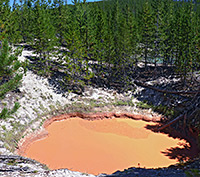
Rabbit Creek Group Length 3 miles (4.8 km) round trip Elevation change 200 feet (61 meters) Trailhead Pullout on the west side of the Grand Loop Road Rating (1-5) ★★★★★ Off trail hike across meadows and through woodland, to a backcountry thermal area around the upper end of a short, east-side tributary of the Firehole River; about 40 major hot springs, of varying colors and activity levels. The springs are divided into two dispersed groups, separated by a short, wooded slope; land around the lower section is quite open, mostly extensive white flats, while the upper area is wooded and some pools are completely enclosed by dense forest. |
|
Shoshone Lake Length 20.5 miles (33 km) Elevation change 400 feet (122 meters) Trailhead Short spur road on the west side of the highway, 2.5 miles from Old Faithful Rating (1-5) ★★★★★ The trail to Shoshone Geyser Basin and Shoshone Lake begins at the parking area for the Kepler Cascades, and first reaches Lone Star Geyser after 2.5 miles. A short distance beyond are more hot springs and pools in meadows and woodland along the upper Firehole River, then the path climbs a ridge to Grants Pass on the continental divide and drops down the far side into the valley of Shoshone Creek, where the Bechler River Trail forks off to the south. The geyser basin, and the west side of the lake, are 2 miles further at the mouth of the valley (8.5 miles from the start). From the basin the Shoshone Lake Trail winds eastwards through the forest, rejoining the lake at its southeast corner, after crossing the Lewis River. The De Lacy Creek Trail allows for a continuation hike around the east edge of the lake, while the main route enters deep forest once more, crossing several minor drainages and eventually meeting the south entrance road just north of Lewis Lake. |
|
Summit Lake Length 16 miles (25.7 km) Elevation change 1270 feet (387 meters) Trailhead Biscuit Basin Rating (1-5) ★★★★★ The only path across the extensive Madison Plateau in the southwest of Yellowstone is the Summit Lake Trail, starting at Biscuit Basin, and reaching, as a half way point, circular Summit Lake at 8,553 feet, just on the Atlantic side on the continental divide. The route from the basin is a steady climb up a small ravine, through sparse forest without any thermal features, though near the lake is an area of hot springs and other pools. West of the divide, the path is almost level for many miles, through more open woodland and meadows but passing no more sites of interest, until it descends to the west boundary of the park, and meets a track in the Targhee National Forest. |
|
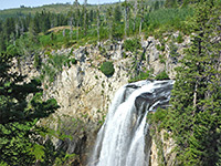
Union Falls Length 1.75 miles (2.8 km) Elevation change 100 feet (30 meters) Trailhead Along the Mountain Ash Creek Trail Rating (1-5) ★★★★★ Regarded as one of the most spectacular waterfalls in Yellowstone, and the second highest (after the Lower Falls of the Yellowstone River), Union Falls is a 265 drop formed at the confluence of two upper forks of Mountain Ash Creek. The falls are reached by a spur path along the Mountain Ash Creek trail, and are 10 miles from the starting point beside Grassy Lake Reservoir. |
All Contents © Copyright The American Southwest | Comments and Questions | Contribute | Affiliate Marketing Disclosure | Site Map


