Shoshone Geyser Basin, Yellowstone National Park
Wyoming > Yellowstone National Park > The Southwest > Hiking > Shoshone Geyser Basin
Shoshone Geyser Basin
Long hike to Yellowstone's largest backcountry geyser area - hundreds of large and active thermal features, with a scenic setting on the north shore of Shoshone Lake. Passes Lone Star Geyser en route then encounters a mixture of forest and meadowland, before descending to the lake via a wooded ravine. The majority of the basin can only be seen by off trail exploration, however the areas away from the path have recently been closed, to protect the formations
Length: 8.5 miles
Elevation change: 400 feet
Difficulty: Moderate - not difficult, but long (for a day trip)
Type: One way. Basin is also reachable via the De Lacy Creek Trail
Usage: Low to medium
Season: Summer, fall
Trailhead: Short spur road on the west side of the highway, 2.5 miles south of Old Faithful junction
Rating (1-5): ★★★★★
With nearly 500 geothermal features, Shoshone Geyser Basin is the largest backcountry geyser area in Yellowstone National Park, and it has a scenic location on partly wooded land by the west shore of Shoshone Lake, which is also noteworthy, for being the second largest body of water in the park, after Yellowstone Lake. The basin contains several quite regularly-erupting geysers though most of its components are hot springs and pools, exhibiting a great range of sizes, shapes, behavior, and especially colors - sulfur is much in evidence, both black and yellow forms, the water in the pools has a range of blue-grey tints, and the cyanobacteria inhabiting the springs and their run-off channels are found in a variety of bright shades of red, green and yellow.
The shortest path to the basin is 8.5 miles in length and several hours could be spent exploring, so most people stay overnight at one of several nearby lakeside campsites, though visiting the area on a day hike is quite possible. The trail itself is also quite interesting, passing several smaller thermal areas (including Lone Star Geyser), and diverse river, meadow, forest and mountain terrain - the scenery changes every mile or so along the way - but even so, the path is lightly traveled, the basin is can usually be appreciated alone, and the formations are all in a pristine condition.
Trail map for Yellowstone National Park.
Shoshone Geyser Basin and the Shoshone Lake Trail - 26 views, Shoshone Geyser Basin (Western Group) - 15 views.
Thermal features of the geyser basin (mp4; 3:58 min; 31 mb).
Shoshone Lake can be reached from several directions - the shortest route (to the northeast corner) is via the first 3 miles of the De Lacy Creek Trail, though from here the geyser basin is a further 7 miles away, along the lake's north shore. The most direct path to Shoshone Geyser Basin is the Shoshone Lake Trail, beginning at the end of a very short side road, forking off the Grand Loop highway 2.5 miles from Old Faithful junction, just south of the larger turn-off for the Kepler Cascades. Most people come here for the 2.5 mile hike to Lone Star Geyser; the full journey to Shoshone Lake is another 6 miles, including a climb over the continental divide at Grants Pass.
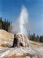
The route to Lone Star Geyser is along a disused road, originally paved but the surface is now cracked and eroded away in many places. The surroundings are thick, undamaged woodland, with the Firehole River running alongside, and a few small hot vents in the forest to the west. The road ends just before the geyser and a regular trail continues, now through thinner woodland, past a junction (with the Howard Eaton Trail from Old Faithful) and primitive campsite OA1, down to a footbridge over the river, and into a region of scattered hot springs, including various small vents right next to the path and several bigger pools a little way west, near the river. The active area extends for about 1/3 mile, until the path crosses a small stream on a boardwalk, enters thicker forest and starts to climb, staying quite far above the valley floor for half a mile before dropping back down into a larger expanse of flat meadowland, filled with tall grass and home to quite a few bison. More boardwalks take the trail across marshy land and another stream until the route leaves the valley for the last time and starts the 300 foot ascent to Grants Pass. The climb starts off quite steep, through a dense, dark forest of tall fir trees, but the gradient soon lessens, and the trees become slightly smaller and more widely spaced. For a mile or so the land is almost level, approaching the continental divide and the 8,000 foot pass, which is not signposted and offers no views, since all the surroundings are thickly forested.
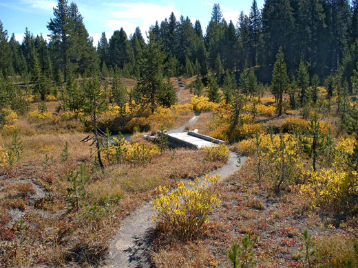
Yellow-leaved bushes in a sunny area along the Shoshone Lake Trail, a little way south of Grants Pass
A short descent into the top of a valley reaches a junction with the Bechler River Trail, just as the trees open out into a flattish area crossed by a curvy stream edged by grass and bushes that take on a bright yellow color in late summer. The stream joins the larger drainage of Shoshone Creek which starts a gradual descent towards the lake through a ravine that becomes 300 feet deep and is quite photogenic, as the waters wind through tall trees and grassy banks. The trail crosses the upper stream several times on makeshift log bridges, then stays on the east side, rising quite high above the valley floor as the sides steepen. Outcrops of grey-brown rhyolite mixed with patches of ashen earth hint of past volcanic activity, and soon the distant steam plumes from the geyser basin come into view, as the trail finally descends into the marshy meadows around the lower end of the valley. There is one junction along the way, with a cutoff trail used by horses to avoid walking through the geyser basin; this rejoins the main route after 2 miles through the forest.
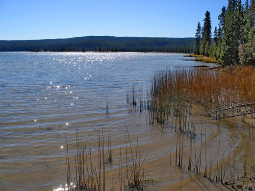
The North Shore Trail (from De Lacy Creek) joins from the left, just before the edge of the forest, and a short spur forks off shortly afterwards, leading to a campsite by the edge of Shoshone Lake. Like all such sites, it is equipped with metal bear-proof food lockers, and the soft sand around the water's edge is a good place to look for bear tracks. The main path continues into the geyser basin, passing right next to some of its largest hot springs, though only a relatively small number of features are within sight of the path - most are off trail to the west, on the far side of Shoshone Creek. Pools and geyser cones line the path for half a mile before it moves away to the southeast, runs alongside the shoreline for a while then climbs back into the hills, en route to the lake's exit channel (Lewis River) at the southeast corner.
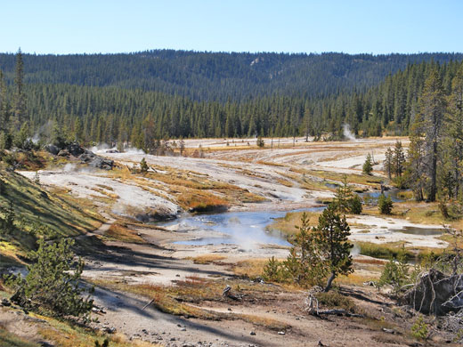
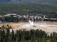
As the Shoshone Lake Trail enters the geyser basin, the land takes on the familiar bleached white appearance, kept mostly free of vegetation by the subterranean heat and the alkalinity (or acidity) of the ground water. The first points of interest are several large, shallow pools and small fumaroles (part of the Sulphur Hills Group), followed by a cluster of more energetic vents right on the river bank, spitting out hot water and edged by black or yellow sulphur deposits. Next are some of the biggest features including the most regularly erupting - Minute Man Geyser performs about every 5 minutes, shooting up water and steam from a substantial, bulbous vent surrounded by pools, deposited formations and patterned run-off channels. Adjacent Shield Geyser is also quite often active, and has a smaller though more symmetric vent, filled with clear, bubbling water. Another of the dozen or so springs with an official name is Soap Kettle, also smooth-sided, constantly bubbling and erupting every 20 minutes.
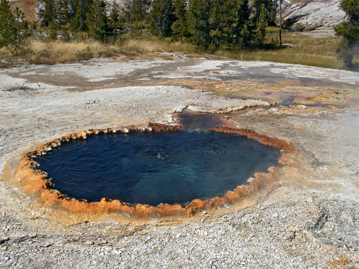
The path rises to cross a small wooded area and descends to another collection of pools, known as the Orion Group. There are no proper geysers here, just a variety of interesting springs and mudpots, some large and deep, with water levels several feet below the surface. Many have a thin crust around the edge so great care is needed if leaving the path. Features include Black Boiler Spring, a neat pool of dark water, circled by a delicate scalloped rim covered by reddish cyanobacteria. Taurus Spring presents a similar appearance but is rather larger - 6 feet across and constantly bubbling, producing a small run-off stream. Impenetrable Spring has quite a big pool of clear bluish water bordered by layered, overhanging walls of white sinter. Close to the path, Union Geyser was once the main attraction of Shoshone Geyser Basin but its three raised vents became almost dormant in the 1970s.
Past the Orion Group, the path leaves the basin, enters the forest, crosses Shoshone Creek and soon reaches Shoshone Lake, but there are many more springs away from the trail - both east, between the path and the lake, and especially west, on the far side of Shoshone Creek. All this area has recently been closed, however, due to overuse and damage to some of the formations; the following description is for reference only. The creek is shallow but too wide to jump over, though it can be crossed in comfort by walking along a fallen tree stump that forms a natural bridge, about 400 feet from the edge of the Orion Group. A big area of pools, channels and depositional terraces extends northwards, but perhaps the most interesting area is to the south, a collection of around 60 pools and vents designated the Western Group (aka the Fall Creek Group).
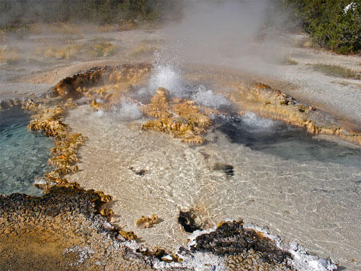
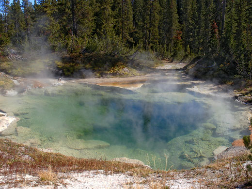
Unlike the rest of the basin which is quite open, the features in the Western Group are surrounded by thick pine forest. Many of the pools are large and pretty, and although most bubble only gently, Boiling Cauldron is very energetic, comprising several fierce vents edged by jagged, intricate, mustard-colored sinter deposits, sending scalding water down an unusual yellow-green run-off stream. Other pools are red, brown or orange in color, and one sustains a delicate terraced formation, extending downhill for several yards. The biggest spring is Great Crater, a deep, steaming pool 30 feet across and filled with greenish-blue water. The pools are less hot further west as the ground gradually rises, becoming completely forested once past the edge of the basin. Another site worth a visit is a small, non-thermal lake about 400 feet beyond the westernmost pool, on the far side of the Horse Cutoff Trail - this pretty pond has tress and grass all around, lily pads on the water, and a tiny island in the middle, home to a lone pine tree.
The shortest path to the basin is 8.5 miles in length and several hours could be spent exploring, so most people stay overnight at one of several nearby lakeside campsites, though visiting the area on a day hike is quite possible. The trail itself is also quite interesting, passing several smaller thermal areas (including Lone Star Geyser), and diverse river, meadow, forest and mountain terrain - the scenery changes every mile or so along the way - but even so, the path is lightly traveled, the basin is can usually be appreciated alone, and the formations are all in a pristine condition.
Location
Trail map for Yellowstone National Park.
Photographs
Shoshone Geyser Basin and the Shoshone Lake Trail - 26 views, Shoshone Geyser Basin (Western Group) - 15 views.
Video of Shoshone Geyser Basin
Thermal features of the geyser basin (mp4; 3:58 min; 31 mb).
Shoshone Lake Trailheads
Shoshone Lake can be reached from several directions - the shortest route (to the northeast corner) is via the first 3 miles of the De Lacy Creek Trail, though from here the geyser basin is a further 7 miles away, along the lake's north shore. The most direct path to Shoshone Geyser Basin is the Shoshone Lake Trail, beginning at the end of a very short side road, forking off the Grand Loop highway 2.5 miles from Old Faithful junction, just south of the larger turn-off for the Kepler Cascades. Most people come here for the 2.5 mile hike to Lone Star Geyser; the full journey to Shoshone Lake is another 6 miles, including a climb over the continental divide at Grants Pass.
The Trail to Grants Pass
The route to Lone Star Geyser is along a disused road, originally paved but the surface is now cracked and eroded away in many places. The surroundings are thick, undamaged woodland, with the Firehole River running alongside, and a few small hot vents in the forest to the west. The road ends just before the geyser and a regular trail continues, now through thinner woodland, past a junction (with the Howard Eaton Trail from Old Faithful) and primitive campsite OA1, down to a footbridge over the river, and into a region of scattered hot springs, including various small vents right next to the path and several bigger pools a little way west, near the river. The active area extends for about 1/3 mile, until the path crosses a small stream on a boardwalk, enters thicker forest and starts to climb, staying quite far above the valley floor for half a mile before dropping back down into a larger expanse of flat meadowland, filled with tall grass and home to quite a few bison. More boardwalks take the trail across marshy land and another stream until the route leaves the valley for the last time and starts the 300 foot ascent to Grants Pass. The climb starts off quite steep, through a dense, dark forest of tall fir trees, but the gradient soon lessens, and the trees become slightly smaller and more widely spaced. For a mile or so the land is almost level, approaching the continental divide and the 8,000 foot pass, which is not signposted and offers no views, since all the surroundings are thickly forested.

Yellow-leaved bushes in a sunny area along the Shoshone Lake Trail, a little way south of Grants Pass
Grants Pass to the Basin
A short descent into the top of a valley reaches a junction with the Bechler River Trail, just as the trees open out into a flattish area crossed by a curvy stream edged by grass and bushes that take on a bright yellow color in late summer. The stream joins the larger drainage of Shoshone Creek which starts a gradual descent towards the lake through a ravine that becomes 300 feet deep and is quite photogenic, as the waters wind through tall trees and grassy banks. The trail crosses the upper stream several times on makeshift log bridges, then stays on the east side, rising quite high above the valley floor as the sides steepen. Outcrops of grey-brown rhyolite mixed with patches of ashen earth hint of past volcanic activity, and soon the distant steam plumes from the geyser basin come into view, as the trail finally descends into the marshy meadows around the lower end of the valley. There is one junction along the way, with a cutoff trail used by horses to avoid walking through the geyser basin; this rejoins the main route after 2 miles through the forest.
Shoshone Lake
The North Shore Trail (from De Lacy Creek) joins from the left, just before the edge of the forest, and a short spur forks off shortly afterwards, leading to a campsite by the edge of Shoshone Lake. Like all such sites, it is equipped with metal bear-proof food lockers, and the soft sand around the water's edge is a good place to look for bear tracks. The main path continues into the geyser basin, passing right next to some of its largest hot springs, though only a relatively small number of features are within sight of the path - most are off trail to the west, on the far side of Shoshone Creek. Pools and geyser cones line the path for half a mile before it moves away to the southeast, runs alongside the shoreline for a while then climbs back into the hills, en route to the lake's exit channel (Lewis River) at the southeast corner.
Thermal Features Along the Trail
As the Shoshone Lake Trail enters the geyser basin, the land takes on the familiar bleached white appearance, kept mostly free of vegetation by the subterranean heat and the alkalinity (or acidity) of the ground water. The first points of interest are several large, shallow pools and small fumaroles (part of the Sulphur Hills Group), followed by a cluster of more energetic vents right on the river bank, spitting out hot water and edged by black or yellow sulphur deposits. Next are some of the biggest features including the most regularly erupting - Minute Man Geyser performs about every 5 minutes, shooting up water and steam from a substantial, bulbous vent surrounded by pools, deposited formations and patterned run-off channels. Adjacent Shield Geyser is also quite often active, and has a smaller though more symmetric vent, filled with clear, bubbling water. Another of the dozen or so springs with an official name is Soap Kettle, also smooth-sided, constantly bubbling and erupting every 20 minutes.
Orion Group
The path rises to cross a small wooded area and descends to another collection of pools, known as the Orion Group. There are no proper geysers here, just a variety of interesting springs and mudpots, some large and deep, with water levels several feet below the surface. Many have a thin crust around the edge so great care is needed if leaving the path. Features include Black Boiler Spring, a neat pool of dark water, circled by a delicate scalloped rim covered by reddish cyanobacteria. Taurus Spring presents a similar appearance but is rather larger - 6 feet across and constantly bubbling, producing a small run-off stream. Impenetrable Spring has quite a big pool of clear bluish water bordered by layered, overhanging walls of white sinter. Close to the path, Union Geyser was once the main attraction of Shoshone Geyser Basin but its three raised vents became almost dormant in the 1970s.
Off-Trail Features
Past the Orion Group, the path leaves the basin, enters the forest, crosses Shoshone Creek and soon reaches Shoshone Lake, but there are many more springs away from the trail - both east, between the path and the lake, and especially west, on the far side of Shoshone Creek. All this area has recently been closed, however, due to overuse and damage to some of the formations; the following description is for reference only. The creek is shallow but too wide to jump over, though it can be crossed in comfort by walking along a fallen tree stump that forms a natural bridge, about 400 feet from the edge of the Orion Group. A big area of pools, channels and depositional terraces extends northwards, but perhaps the most interesting area is to the south, a collection of around 60 pools and vents designated the Western Group (aka the Fall Creek Group).
Western Group
Unlike the rest of the basin which is quite open, the features in the Western Group are surrounded by thick pine forest. Many of the pools are large and pretty, and although most bubble only gently, Boiling Cauldron is very energetic, comprising several fierce vents edged by jagged, intricate, mustard-colored sinter deposits, sending scalding water down an unusual yellow-green run-off stream. Other pools are red, brown or orange in color, and one sustains a delicate terraced formation, extending downhill for several yards. The biggest spring is Great Crater, a deep, steaming pool 30 feet across and filled with greenish-blue water. The pools are less hot further west as the ground gradually rises, becoming completely forested once past the edge of the basin. Another site worth a visit is a small, non-thermal lake about 400 feet beyond the westernmost pool, on the far side of the Horse Cutoff Trail - this pretty pond has tress and grass all around, lily pads on the water, and a tiny island in the middle, home to a lone pine tree.
Shoshone Geyser Basin - Similar Hikes
All Contents © Copyright The American Southwest | Comments and Questions | Contribute | Affiliate Marketing Disclosure | Site Map


