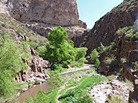
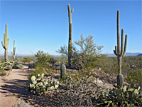
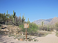
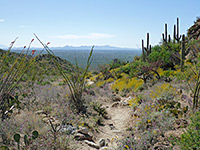
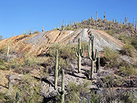
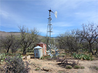
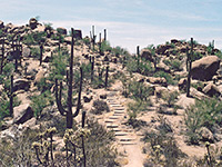
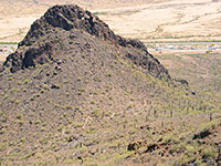
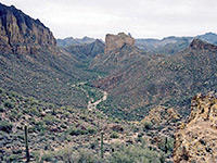
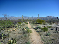
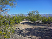
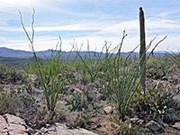
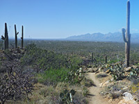
Southeast Arizona has four NPS units with trails, Chiricahua, Coronado, Fort Bowie and Saguaro; elsewhere, popular hiking locations include Picacho Peak, the Superstition Mountains and the Santa Catalina Mountains, for example in Sabino Canyon.
Map shows trailhead locations
| 1. Apache Trail Canyon Length 3 miles (4.8 km); round trip, for the whole canyon Elevation change 400 feet (122 meters) Difficulty Moderate - route-finding required to enter the canyon; wading to see some of the slot, rappelling if exploring all the slot Rating (1-5) ★★★★★ Minor, south-side tributary of Mesquite Creek which is enclosed for nearly a mile and forms 500 feet of shallow slot canyon, containing pools and dryfalls. Located right beside the Apache Trail. The slot section can be explored in less than an hour, while up to two hours are needed if continuing downstream along the deeper, wider lower gorge. |
| 2. Aravaipa Canyon, Aravaipa Canyon Length 10.4 miles (16.7 km) Elevation change 460 feet (140 meters) Difficulty Moderate; no major obstacles, but the canyon is long, overgrown in places, and requires some wading Rating (1-5) ★★★★★ Hike through the spectacular, riparian, Sonoran Desert drainage of Aravaipa Canyon, from west to east: from relatively wide, wooded surroundings into a narrower, cliff-bound gorge, followed by a long, straight, wider section as the rocks change from volcanic to conglomerate. The final 2 miles, to the eastern trailhead, are narrower again, and more winding. Permits required. |
| 3. Bear Canyon Trail, Sabino Canyon Recreation Area Length 2.2 miles (3.5 km); to the base of the falls Elevation change 600 feet (183 meters) Difficulty Moderate Rating (1-5) ★★★★★ Popular route up a rocky canyon holding a permanent stream and lined by many cacti, to the base of the Seven Falls, a group of pools and cascades. The trail is stony, mostly level, and not particularly difficult, except at the rare times of high water flow when some of the seven creek crossings can be a bit tricky. |
| 4. Big Balanced Rock Trail, Chiricahua National Monument Length 1 mile (1.6 km) Elevation change 150 feet (46 meters) Difficulty Easy Rating (1-5) ★★★★★ One of the largest balanced rocks in the national monument overlooks the upper end of Sarah Deming Canyon, and is reached by a fairly level trail that crosses open, mostly treeless ground, partly burnt in a recent wildfire. There are good views along the way towards distant peaks, especially to the south. The three-way junctions at either end are with Heart of Rocks and Sarah Deming trails to the west and Inspiration Point/Ed Riggs trails to the east. |
| 5. Bog, Kent and Sylvester Springs Loop, Madera Canyon Length 5.8 miles (9.3 km); round trip Elevation change 1750 feet (533 meters) Difficulty Moderate; some steep sections, with loose stones Rating (1-5) ★★★★★ Three small springs in two steep ravines on the east side of Madera Canyon, one also containing pools and minor waterfalls. Reached by a loop hike generally through thickly wooded terrain, but with some views of the main canyon. The hike is sometimes known as the Three Springs Trail, and typically takes between 2.5 and 4 hours. |
| 6. Brown Mountain Trail, Tucson Mountain Park Length 4 miles (6.4 km); round trip Elevation change 370 feet (113 meters) Difficulty Moderate Rating (1-5) ★★★★★ Loop up and along a narrow ridge with far-reaching views, returning via rocky land below, partially alongside a dry wash across colorful bedrock |
| 7. Cactus Wren, Saguaro National Park Length 1.5 miles (2.4 km) Elevation change 200 feet (61 meters) Difficulty Easy Rating (1-5) ★★★★★ Two paths lead north from the Signal Hill picnic area over gently sloping plains and dry washes near the west edge of the park, ending at the corner of Sandario and Rudasill roads, and together they form a loop of 4 miles. Both pass similar scenery of saguaro, cholla, palo verde, mesquite and various other cacti. The Cactus Wren Trail is the shorter, and forms the eastern half; the Manville Trail completes the round trip. |
| 8. Canyon Loop Trail, Catalina State Park Length 2.3 miles (3.7 km); (loop) Elevation change 200 feet (61 meters) Difficulty Easy Rating (1-5) ★★★★★ This scenic loop trail is the most popular of the small number of paths in Catalina State Park, encountering a seasonal wash, an open plateau and flourishing groves of the saguaro cactus, plus many other desert plants. |
| 9. Cochise Trail, Cochise Stronghold Length 4.5 miles (7.2 km); between the two trailheads Elevation change 1060 feet (323 meters) Difficulty Moderate; relatively long, and much is exposed, and hot in summer Rating (1-5) ★★★★★ Varied route along shallow, partly wooded ravines and open slopes, right across the crest of the Dragoon Mountains, giving excellent views of the rock formations of Cochise Stronghold. |
| 10. Coronado Cave Trail, Coronado National Memorial Length 0.5 miles (0.8 km) Elevation change 400 feet (122 meters) Difficulty Easy, just a little steep Rating (1-5) ★★★★★ Coronado Cave is a short, smooth-walled limestone cavern consisting of several linked chambers, located a little way up a tributary ravine on the north side of Montezuma Canyon. Free permits are required to enter the cave, obtainable from the visitor center from where the path begins |
| 11. Coronado Peak Trail, Coronado National Memorial Length 0.4 miles (0.6 km) Elevation change 300 feet (91 meters) Difficulty Easy Rating (1-5) ★★★★★ Near the end of the park road, Montezuma Pass is already quite high, but the short Coronado Peak Trail climbs another 300 feet to an isolated summit for even better views. Many miles of the international border fence are visible below, with the hills and valleys of Mexico beyond |
| 12. Desert Discovery Trail, Saguaro National Park Length 0.4 miles (0.6 km); (loop) Elevation change level feet (0 meters) Difficulty Easy; paved Rating (1-5) ★★★★★ On Kinney Road, a mile from the Red Hills visitor center, the paved, wheelchair-accessible Desert Discovery Nature Trail is the shortest and easiest footpath in the park, providing a good introduction to the plants and animals found in the Sonoran Desert. Information boards along the trail describe the most common species. |
| 13. Douglas Spring Trail, Saguaro National Park Length 8.8 miles (14.2 km); to Cowhead Saddle Elevation change 3550 feet (1082 meters) Difficulty Moderate to strenuous Rating (1-5) ★★★★★ The Douglas Spring Trail provides a slightly shorter and less steep route into the backcountry of Saguaro National Park compared to the other main path (Tanque Verde Ridge), though this is still a strenuous hike. The trailhead is at the east end of Speedway Boulevard, in a flat region of dense saguaro, but after a short distance the path begins to climb, passing several junctions with other trails after which the saguaro fade away and are replaced by creosote bushes, yucca, mesquite trees, and eventually, pine woodland. |
| 14. Echo Canyon Trail, Chiricahua National Monument Length 1.6 miles (2.6 km) Elevation change 450 feet (137 meters) Difficulty Easy to moderate Rating (1-5) ★★★★★ The Echo Canyon Trail is perhaps the most popular path in Chiricahua National Monument, following a rocky ridge past many huge volcanic boulders, some of which form enclosed, cave-like spaces (the Grottoes, after 0.5 miles) and a narrow, sheer-walled passage (Wall Street, after nearly 1 mile). The path then descends to the forested floor of a sheltered valley (Echo Park), which contains a few seasonal pools, then rounds a corner to a grand viewpoint high above two deep ravines, and on to a junction with the Hailstone and Upper Rhyolite Canyon trails. |
| 15. Fish Creek, Upper Fish Creek Length 1.5 miles (2.4 km); to the first major tributary Elevation change 270 feet (82 meters) Difficulty Strenuous; canyon is overgrown and filled with boulders Rating (1-5) ★★★★★ Off trail hike along a deep canyon through the Superstition Mountains which holds a permanent stream, forming pretty pools and small cascades; enclosed by steep, volcanic rocks with many saguaro cacti. Just a mile or so is enough to appreciate the scenery, but the drainage can be followed much further. |
| 16. Fort Bowie Trail, Fort Bowie National Historic Site Length 1.5 miles (2.4 km) Elevation change 350 feet (107 meters) Difficulty Easy Rating (1-5) ★★★★★ Fort Bowie is one of very few NPS units reachable only by trail, by an interesting route that climbs gently up a wide, partly wooded valley, passing an old cemetery, several small ruins, a reconstructed abode dwelling and a historic spring. The path enters the fort from the west, and at least one hour can be spent inspecting the various buildings, most just foundations. The first part of the return journey is via an alternative trail that climbs to a rocky ridge, giving good views of the fort below. |
| 17. Gould Mine Trail, Saguaro National Park Length 1.1 miles (1.8 km); (2.5 miles for the loop) Elevation change 260 feet (79 meters) Difficulty Easy Rating (1-5) ★★★★★ The path up a cactus-studded ravine to the remains of Gould Mine is just over a mile but is often combined with parts of the Sendero Esperanza and King Canyon trails to form a circular route of 2.5 miles. The mine was in use for a short time around 1900, when a small amount of copper ore was excavated, and today its location is evident from tailings piles and wooden relics. The trailhead is the same as for the King Canyon route, along Kinney Road. |
| 18. Hamburg Trail, Ramsey Canyon Preserve Length 2.4 miles (3.9 km) Elevation change 1300 feet (396 meters) Difficulty Moderate; steep and rocky in places Rating (1-5) ★★★★★ Secluded path further up Ramsey Canyon, leaving the far end of the nature loop and climbing steeply to pass a cliff-lined section, then following close to the streambed, through thick woodland, past pools and cascades, to an old mine site |
| 19. Heart of Rocks Trail, Chiricahua National Monument Length 1.1 (loop) miles (1.8 km) Elevation change 250 feet (76 meters) Difficulty Easy to moderate - some steep sections Rating (1-5) ★★★★★ The shortest approach to the Heart of Rocks is via the Ed Riggs, Mushroom Rock and Big Balanced Rock trails (3.1 miles); this latter ends at a three-way junction, one route being the start of the 1.1 mile loop through some of the most spectacular pinnacles and eroded rocks in the park. The path descends a little then splits, whereupon each branch climbs quite steeply, eventually giving good, long distance views of Rhyolite Canyon to the north. |
| 20. Hieroglyphic Trail, Superstition Mountains Length 1.5 miles (2.4 km) Elevation change 650 feet (198 meters) Difficulty Easy; just a few rocky areas towards the upper end Rating (1-5) ★★★★★ One of the most accessible hikes in the Superstition Mountains - short path climbing gently across a cactus-covered hillside close to a rocky dry wash, ending at some seasonal pools, beside which are many ancient petroglyphs. Good views all along the trail, of extensive desert plains bearing many saguaro. |
| 21. Hope Camp, Saguaro National Park Length 2.8 miles (4.5 km) Elevation change level feet (0 meters) Difficulty Easy Rating (1-5) ★★★★★ One of two paths beginning from the lesser used Loma Alta trailhead at the southwest corner of the Rincon Mountain District, the Hope Camp Trail runs close to Rincon Creek along an old vehicle track, through bushy land and some riparian areas, still with many large saguaros. The trail passes two abandoned cattle stations - Deer Camp after 1.25 miles and Hope Camp at the end, from where the North Hope Trail continues for 0.4 miles, across level, open ground that allows good views of the surrounding hills. |
| 22. Hugh Norris Trail, Saguaro National Park Length 4.9 miles (7.9 km) Elevation change 2130 feet (649 meters) Difficulty Strenuous Rating (1-5) ★★★★★ This is the longest trail in the park, and has the greatest elevation gain. It climbs up a short, steep canyon then follows a ridge of increasing height all the way to the summit of Wasson Peak, for unsurpassed views of the surrounding mountains and desert. En route are many fine saguaro and other cacti, mixed with large rounded bounders, all surrounded by coarse granitic sand. |
| 23. Hunter Trail, Picacho Peak State Park Length 2 miles (3.2 km) Elevation change 1400 feet (427 meters) Difficulty Strenuous Rating (1-5) ★★★★★ An exciting path to the summit of an extinct volcano, surrounded by flat desert plains half way between Tucson and Casa Grande. The route is steep and exposed towards the top, aided by cables and railings. Spectacular views from the summit; many saguaro and other desert plants en route. |
| 24. Inspiration Point, Chiricahua National Monument Length 0.5 miles (0.8 km) Elevation change 100 feet (30 meters) Difficulty Easy Rating (1-5) ★★★★★ Inspiration Point is an overlook on the south side of upper Rhyolite Canyon, reached by a half mile spur trail over a mostly treeless plateau, starting at the junction of the Big Balanced Rock and Mushroom Rock trails. |
| 25. Joe's Canyon Trail, Coronado National Memorial Length 3 miles (4.8 km) Elevation change 1340 feet (408 meters) Difficulty Moderate; steep towards the lower end Rating (1-5) ★★★★★ This path descends 1,350 feet from Montezuma Pass Overlook (at the west edge of the national memorial) along a side canyon back to the visitor center, initially through bushy grassland with good views over the mountains, then into oak woodland. The route is best hiked downhill as a one-way trip, if a car shuttle is available |
| 26. La Barge Canyon and the Boulder Canyon Trail, Superstition Mountains Length 2.5 miles (4 km); (to La Barge Canyon) Elevation change 500 feet (152 meters) Difficulty Moderate Rating (1-5) ★★★★★ Varied route that climbs steadily giving good views of Canyon Lake and the surrounding mountains then descends into a deep drainage (La Barge Canyon), which can be followed south further into the hills, or north through a narrows section back to the trailhead. |
| 27. Loma Verde Trail, Saguaro National Park Length 2.2 miles (3.5 km) Elevation change 120 feet (37 meters) Difficulty Easy Rating (1-5) ★★★★★ Running across the northwestern corner of the park, the Loma Verde trail has a gentle gradient as it crosses undulating sandy land and small washes, in the shadow of the Rincon Mountains. The southern trailhead is along Cactus Forest Drive, from where the path heads north, past regular intersections with other trails (Squeeze Pen, Cholla, Pink Hill and Wentworth) before ending at a junction with the Shantz Trail. Various loop trails are possible, the shortest at 3 miles. |
| 28. Lower Cliff Dwelling Trail, Tonto National Monument Length 0.5 miles (0.8 km) Elevation change 350 feet (107 meters) Difficulty Easy, paved, though fairly steep Rating (1-5) ★★★★★ The main (lower) cliff dwellings at Tonto National Monument are reached by a self-guided trail which leads from the visitor center/museum quite steeply up the side of a hill. Along the way are notices about the local plant life. A ranger is usually in attendance at the ruin. A 0.25 mile spur trail passes more examples of desert plants. |
| 29. Lower Fish Creek, Superstition Mountains Length 5.5 miles (8.8 km); to the Salt River; shorter hikes possible Elevation change 500 feet (152 meters) Difficulty Moderate; navigating through often dense vegetation, and wading in the creek Rating (1-5) ★★★★★ Permanent drainage through a deep, overgrown and relatively wide canyon; forms little cascades and long, shallow pools. Many wildflowers on the canyon floor, and saguaro on the cliffs. Explorable by off-trail hiking. |
| 30. Manville, Saguaro National Park Length 2.5 miles (4 km) Elevation change 200 feet (61 meters) Difficulty Easy Rating (1-5) ★★★★★ The Manville Trail climbs gradually from the junction of Sandario and Rudasill roads to the Signal Hill picnic area, where it meets the Cactus Wren Trail to form a loop; both pass through typical Sonoran Desert scenery. Most is close to the road and so within range of traffic noise. |
| 31. Massai Point Trail, Chiricahua National Monument Length 0.5 miles (0.8 km); loop Elevation change 50 feet (15 meters) Difficulty Easy Rating (1-5) ★★★★★ The park road ends at 6,870 foot Massai Point, often a very windy location, but providing fine, 360 degree views over the surroundings. A short, partly paved nature trail loops through the lightly wooded surroundings, and has informative notices about the local plantlife. |
| 32. Mica View Trail, Saguaro National Park Length 1 mile (1.6 km) Elevation change 40 feet (12 meters) Difficulty Easy Rating (1-5) ★★★★★ The Mica View picnic area is located at the end of a gravel spur road along the north part of the Cactus Forest Loop. From the car park, an easy trail crosses a flat part of the desert with many saguaros, cholla and other opuntia cacti, ending at an alternative trailhead on Broadway Boulevard. A loop hike of 2 miles can be made by turning right, on the Shantz Trail briefly then south along the Cactus Forest Trail for a mile, to a junction with the southern end of the Mica View Trail. |
| 33. Mushroom Rock Trail, Chiricahua National Monument Length 1.2 miles (1.9 km) Elevation change 600 feet (183 meters) Difficulty Easy Rating (1-5) ★★★★★ The small eroded formation of Mushroom Rock is situated just below the rim towards the thickly wooded upper end of Rhyolite Canyon, quite high above the trail through this part of the ravine. The rock is not really an attraction in itself; most people use the path to reach Inspiration Point, Big Balanced Rock and Heart of Rocks, via continuation trails. |
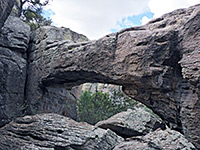
| 34. Natural Bridge, Chiricahua National Monument Length 2.4 miles (3.9 km); to the viewpoint Elevation change 400 feet (122 meters) Difficulty Easy; moderate to strenuous if climbing to the bridge Rating (1-5) ★★★★★ Although just 2,000 feet from the highway, the water-carved span of Natural Bridge requires a 4.8 mile hike to reach, past forested scenery that while pleasant is less spectacular than the rockier areas further along the road. The trail follows a ravine (North Bonita Canyon), crosses a ridge, descends into the larger drainage of Picket Canyon then heads south through pine woodland to the bridge. More can be seen by off-trail hiking |
| 35. Pink Hill Trail, Saguaro National Park Length 1.7 miles (2.7 km) Elevation change level feet (0 meters) Difficulty Easy Rating (1-5) ★★★★★ This connecting trail links the Shantz and Squeeze Pen routes, crossing a mix of overgrown, bushy land either side of three dry washes, and higher, more open plains with a good selection of cacti. The main feature en route is the hill, a low summit that gives mostly unobscured views of the surroundings, across to the Tanque Verde and Santa Catalina ranges |
| 36. Ridge View, Saguaro National Park Length 1.1 miles (1.8 km) Elevation change 330 feet (101 meters) Difficulty Easy Rating (1-5) ★★★★★ The short Ridge View Trail climbs up to a small hill in the southern foothills of Tanque Verde Ridge, for unobstructed views over Rincon Valley and the Rincon Mountains. The trailhead is at the end of Camino Loma Alta, the same starting point as the Hope Camp Trail. |
| 37. Sabino Canyon Trail, Sabino Canyon Recreation Area Length 4.1 miles (6.6 km); to Hutch's Pool Elevation change 500 feet (152 meters) Difficulty Easy to moderate - the initial section is steep. Following the creek, off-trail, is rather more testing Rating (1-5) ★★★★★ Starting at the end of the tram road, this trail climbs further up Sabino Canyon, staying quite high above the creek, giving fine views of the surrounding mountains. The path leads to a tributary stream (the East Fork), where two other routes branch off. Sabino Creek can be reached by a short off-trail hike. |
| 38. Sarah Deming Trail, Chiricahua National Monument Length 1.6 miles (2.6 km) Elevation change 800 feet (244 meters) Difficulty Easy; gradient is fairly gentle Rating (1-5) ★★★★★ The Sarah Deming Trail follows the south side of the namesake canyon, climbing steeply in places, passing a few rocky outcrops but mostly encountering thick woodland with only limited views of the wider surroundings. After crossing the streamway, the easternmost section ascends again, up to a junction with the Big Balanced Rock Trail. |
| 39. Signal Hill Trail, Saguaro National Park Length 0.25 miles (0.4 km) Elevation change 20 feet (6 meters) Difficulty Easy Rating (1-5) ★★★★★ Signal Hill is a small, bushy summit crowned by boulders coated with desert varnish, into which are etched many petroglyphs dating from the Hohokam period of the 13th and 14th centuries. The hill is surrounded by flat desert so makes a good vantage point for photographing the wider landscape, as well as the petroglyphs. The path to the top starts from the Signal Hill picnic site, at the end of a short spur road off the north part of Hohokam Road, and 5 miles from the visitor center. |
| 40. Silver Spur Meadow-Faraway Trail, Chiricahua National Monument Length 1.4 miles (2.3 km) Elevation change 150 feet (46 meters) Difficulty Easy Rating (1-5) ★★★★★ Short path through woodland and meadows in the lower end of Bonita Canyon, visiting three historic sites: chimneys from a 1930s camp, a 19th century log cabin, and Faraway Ranch, a two-story homestead. The canyon is also home to many plant species. |
| 41. Siphon Draw Trail, Lost Dutchman State Park Length 1.6 miles (2.6 km) Elevation change 1300 feet (396 meters) Difficulty Moderate - steep towards the end Rating (1-5) ★★★★★ The best trail in Lost Dutchman State Park climbs steadily from the flat saguaro plains around the campground into the Superstition Mountain foothills, entering a rocky ravine containing an intermittent spring and an unusual slickrock bowl, where the path ends. The ravine can however be followed for several miles more, one target for a day hike being the summit of the Flatiron, 1,800 feet higher. |
| 42. Squeeze Pen Trail, Saguaro National Park Length 2.2 miles (3.5 km) Elevation change 80 feet (24 meters) Difficulty Easy Rating (1-5) ★★★★★ Starting a short way along the Loma Verde route, from the trailhead along the Cactus Forest Loop, the Squeeze Pen Trail is for a while the closest trail to the Rincon Mountains, so its higher elevation makes for the best overall views of the northwest section of the park. After 1.2 miles it turns away north down a dry wash, past a junction with the Pink Hill Trail (part of a 3 mile loop back to the start, also using part of the Loma Verde Trail), and ends at another intersection, with the Wentworth and Kennedy paths. |
| 43. Sugarloaf Mountain Trail, Chiricahua National Monument Length 0.9 miles (1.4 km) Elevation change 470 feet (143 meters) Difficulty Easy Rating (1-5) ★★★★★ Apart from a ridge along the northern boundary, 7,310 foot Sugarloaf Mountain is the highest point in the national monument, and the fire lookout tower on top may be reached by a relatively short trail that climbs the wooded slopes on the north side, then doubles back to the rocky, windswept summit. |
| 44. Tanque Verde Ridge Trail, Saguaro National Park Length 11 miles (17.7 km); full length - to Cowhead Saddle Elevation change 3900 feet (1189 meters) Difficulty Moderate Rating (1-5) ★★★★★ Main route into the high elevation backcountry of Saguaro National Park, climbing steadily through several vegetation zones. Path stays close to the crest of a sloping ridge for most of the journey and so has good views all the way. Just a short hike of a mile or so is rewarding enough, though the round trip to the peak (18 miles), passing through 6 discrete wildlife zones, can be done in one day. The first 0.8 miles is up the side of the ridge to the top, whereupon the path turns northeast and is mostly straight all the way to the peak. |
| 45. Tonto Creek, Tonto Creek Length 1 mile (1.6 km) Elevation change 50 feet (15 meters) Difficulty Moderate Rating (1-5) ★★★★★ Route into the lower end of the narrows of Tonto Creek, where the stream forms cascades and deep pools, some suitable for swimming. The first set of pools is reached after about a mile, but the canyon can be followed at least another mile, if the water is not too deep. |
| 46. Upper Rhyolite Canyon Trail, Chiricahua National Monument Length 1.1 miles (1.8 km) Elevation change 400 feet (122 meters) Difficulty Easy Rating (1-5) ★★★★★ This trail follows the overgrown, boulder-filled streambed of Rhyolite Canyon for half a mile, climbing at each end to junctions with the Echo Canyon/Hailstone trails to the north, and the Sarah Deming/Lower Rhyolite Canyon trails to the west. |
| 47. Valley View Overlook Trail, Saguaro National Park Length 0.4 miles (0.6 km) Elevation change 30 feet (9 meters) Difficulty Easy Rating (1-5) ★★★★★ Along the one-way portion of Hohokam Road, this short path crosses a dry wash and climbs to the top of a small ridge running southwest from Apache Peak, for superb views in all directions, especially north, over vast saguaro-covered plains at the edge of Avra Valley. |
| 48. Vineyard Trail, Theodore Roosevelt Lake Length 2 miles (3.2 km); to the first good viewpoint Elevation change 1260 feet (384 meters) Difficulty Moderate; steep at the start Rating (1-5) ★★★★★ Rewarding path that climbs steeply up the hills overlooking Theodore Roosevelt Dam then traverses westwards across ridges and summits, giving grand views of Apache Lake, the Apache Trail, the Salt River valley and the Four Peaks Wilderness. Part of the Arizona Trail, which continues further west. |
| 49. Waterman Peak Trail, Ironwood Forest National Monument Length 0.9 miles (1.4 km) Elevation change 1150 feet (351 meters) Difficulty Easy to moderate Rating (1-5) ★★★★★ Route up a shallow ravine to a saddle, then over colorful, rocky, cactus-covered slopes to the highest point in the Waterman Mountains, for long distance views over a large area of southern Arizona |
| 50. Wild Burro and Alamo Springs Trails, Tortolita Mountains Length 7.6 miles (12.2 km); loop Elevation change 1070 feet (326 meters) Difficulty Moderate to strenuous Rating (1-5) ★★★★★ Varied loop along a bushy, rocky canyon to a seasonal spring, returning across higher, more undulating terrain. Plenty of cacti and wildflowers, and good views from the upper reaches |
| 51. Yaqui Ridge Trail, Coronado National Memorial Length 2 miles (3.2 km) Elevation change 660 feet (201 meters) Difficulty Moderate Rating (1-5) ★★★★★ The Yaqui Ridge Trail drops moderately steeply down an open, grassy ravine, right to the border with Mexico and international boundary post number 102. The path itself is unremarkable but it is worthwhile to stand at this very remote spot at the edge of the country, or even step over the fence into a different land. |
All Contents © Copyright The American Southwest | Comments and Questions | Contribute | Affiliate Marketing Disclosure | Site Map

