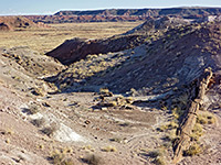
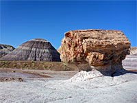
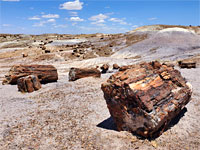
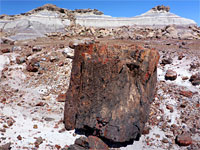
Trails in the northeast quarter of Arizona are relatively few in number; the region contains only three NPS units (Canyon de Chelly, Navajo, Petrified Forest), and most of the land is part of Indian reservations. One other good hiking location is the Painted Desert, an extensive region of colorful badlands and branched ravines.
Map shows trailhead locations
| 1. Agate House Trail, Petrified Forest National Park Length 1 mile (1.6 km) Elevation change 50 feet (15 meters) Difficulty Easy Rating (1-5) ★★★★★ Agate House, a small stone hut, was constructed entirely of petrified wood by Puebloan Indians in the 14th century. The house has been partially reconstructed and is quite an impressive sight. The mostly level trail to the hut passes many petrified wood fragments, though they are not as large as those along the adjacent Long Logs Trail. |
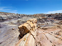
| 2. Black Forest and Onyx Bridge, Petrified Forest National Park Length 2.5 miles (4 km) Elevation change 350 feet (107 meters) Difficulty Moderate - a few steep and rocky places Rating (1-5) ★★★★★ Wilderness region in the north section of the national park, containing badlands, eroded rock formations and much petrified wood including many complete trunks, one (Onyx Bridge) spanning a dry wash. The hike is relatively easy since the terrain is mostly level; seasonal hazards include rainfall which makes the clayish earth difficult to walk over, and the extreme heat of midsummer. |
| 3. Blue Canyon, Blue Canyon Length 2.5 miles (4 km) Elevation change 0 feet (0 meters) Difficulty Easy Rating (1-5) ★★★★★ Off-trail hike through badlands, hoodoos, balanced rocks and other eroded, red and white formations, lining a side valley north of Moenkopi Wash in a remote area of the Hopi Reservation. There is no set route, but a walk of 2 to 3 miles is enough to see most of the area. |
| 4. Blue Mesa Trail, Petrified Forest National Park Length 1 mile (1.6 km); loop Elevation change 130 feet (40 meters) Difficulty Easy, mostly paved, with an unpaved steeper section Rating (1-5) ★★★★★ Reached by a short loop road, Blue Mesa features many logs lying beneath undulating, purple-grey mounds of bentonite clay, below a narrow plateau. A paved trail descends the west side of the mesa and loops around some of the badlands, past a selection of large logs |
| 5. Crystal Forest Trail, Petrified Forest National Park Length 0.75 miles (1.2 km); loop Elevation change 30 feet (9 meters) Difficulty Easy, paved Rating (1-5) ★★★★★ The area known as Crystal Forest was once strewn with especially beautiful logs, which had crevices containing clear quartz and purple amethyst crystals, but all the best specimens were removed by souvenir hunters long ago. A few small crystalline specimens can still be seen, amongst other more typical logs, by the paved 0.75 loop path that has a few short steepish sections across ravines. |
| 6. Devil's Playground, Petrified Forest National Park Length 7.4 miles (11.9 km) Elevation change 200 feet (61 meters) Difficulty Moderate Rating (1-5) ★★★★★ Partial loop in a rarely visited region of badlands, hoodoos and other eroded formations, in the southwest corner of the northern section of the park, near I-40; within the Petrified Forest National Wilderness Area. Only accessible with a permit, of which just three are available each week. Reached by unpaved roads. |
| 7. First Forest Point, Petrified Forest National Park Length 2.1 miles (3.4 km) Elevation change 170 feet (52 meters) Difficulty Moderate Rating (1-5) ★★★★★ Primitive trail/route that descends from the plateau at the end of Jasper Forest Road, across badands with much petrified wood, then over an old wagon trail through a wide grassland valley, past several buttes and up to a mesa, continuing to a viewpoint at its northern edge. The region was once known as First Forest since it provided the first view of petrified wood for travelers along the old trail. |
| 8. Ha Ho No Geh Canyon, Ha Ho No Geh Canyon Length 2.5 miles (4 km); to see some of the upper canyon Elevation change 200 feet (61 meters) Difficulty Easy Rating (1-5) ★★★★★ Long, mostly wide and shallow drainage through banded, multi-colored rocks on the Hopi Reservation in north Arizona, containing cliffs, badlands and hoodoos. Most parts are far from any road, but the southern end is easily accessed by cross-country hiking from Hwy 264. |
| 9. Historic Blue Forest Trail, Petrified Forest National Park Length 1.3 miles (2.1 km) Elevation change 200 feet (61 meters) Difficulty Easy to moderate Rating (1-5) ★★★★★ The most popular of the 'off the beaten path routes', this heads east from the park road across an open plain flanked by bluish mounds, then climbs into stark badlands, winding along some narrow ridges, and descends to an intersection with the paved Blue Mesa Trail |
| 10. Jasper Forest Trail, Petrified Forest National Park Length 1.2 miles (1.9 km) Elevation change 100 feet (30 meters) Difficulty Easy Rating (1-5) ★★★★★ From the parking lot at the Jasper Forest overlook, this trail descends gently to a dry wash then enters an area of much petrified wood, later crossing a minor saddle, rounding a mesa and heading up a larger drainage to the base of Eagle Nest Rock, a once-famous hoodoo that toppled in January 1941. Part of the route follows an old road, constructed in the 1930s; culverts and stretches of gravel can still be seen. |
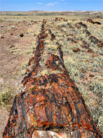
| 11. Long Logs Trail, Petrified Forest National Park Length 1.6 miles (2.6 km); loop Elevation change 50 feet (15 meters) Difficulty Easy Rating (1-5) ★★★★★ At the end of a service road (closed to vehicles), the Long Logs Trail gives perhaps the most impressive views in Petrified Forest National Park - a 1.6 mile circular path passes hundreds of large, beautifully colored examples, some over 30 feet in length. |
| 12. Martha's Butte, Petrified Forest National Park Length 0.9 miles (1.4 km) Elevation change 70 feet (21 meters) Difficulty Moderate; route-finding necessary Rating (1-5) ★★★★★ Short route over open terrain, alongside a wash then past several mounds to the base of a slightly taller peak, the lower slopes of which are covered with large, reddish boulders, some bearing many petroglyphs, the most famous a spiral, solar marker. |
| 13. Potato Canyon Length 9 miles (14.5 km); round trip (approximate) Elevation change 400 feet (122 meters) Difficulty Moderate to difficult - cross-country hiking, route-finding and scrambling Rating (1-5) ★★★★★ Lengthy tributary of Navajo Creek, splitting at its upper end into three deep, narrow, slot canyon branches through richly-colored sandstone, mostly inaccessible unless rappelling |
| 14. Puerco Pueblo, Petrified Forest National Park Length 0.3 miles (0.5 km); loop Elevation change 15 feet (5 meters) Difficulty Easy Rating (1-5) ★★★★★ Short loop around the site of an Ancestral Puebloan dwelling dating from the 1500s, once containing over a hundred rooms. Runs alongside the rim of a shallow canyon for a short distance, within sight of dozens of petroglyphs. |
| 15. Sandal Trail, Navajo National Monument Length 0.6 miles (1 km) Elevation change 160 feet (49 meters) Difficulty Easy, paved Rating (1-5) ★★★★★ This path crosses open slickrock then winds over bushy, undulating ground to a viewpoint on the south edge of a deep canyon, directly opposite Betatakin Ruin but 1,300 feet away, and 500 feet above. As the ruin is in shadow most of the day, situated at the foot of a high, south-facing cliff beneath a big overhang, it is difficult to photograph effectively from this distance, but for most visitors this is the only way to view the site |
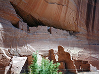
| 16. White House Trail, Canyon de Chelly National Monument Length 1.2 miles (1.9 km) Elevation change 560 feet (171 meters) Difficulty Easy to moderate Rating (1-5) ★★★★★ The only unsupervised trail in the national monument starts at a viewpoint on the southern canyon rim, then descends slickrock slopes and a short ravine to the sandy flats around Chinle Wash, ending beneath the famous White House Ruins, scenically situated in an alcove beneath a 400 foot sandstone cliff, streaked with desert varinsh |
All Contents © Copyright The American Southwest | Comments and Questions | Contribute | Affiliate Marketing Disclosure | Site Map

